Parc Clichy-Batignolles – Martin-Luther-King
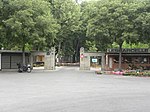
The Parc Clichy-Batignolles or Parc Clichy-Batignolles - Martin Luther King is a green space in Paris' 17th arrondissement (district). It is part of the Clichy Batignolles urban development project, which started in 2001, transforming 54 hectares (130 acres) of land formerly occupied by freight yards for the French railway company SNCF. The name of the park is derived from: proximity to the site of a nineteenth century Porte de Clichy, a gate in Paris' Thiers wall that opened to the commune of Clichy, Hauts-de-Seine; proximity to the former SNCF Batignolles station; and a tribute to the legacy of slain civil rights leader Martin Luther King Jr. Within the larger Clichy Batignolles project, the Parc Clichy-Batignolles - Martin Luther King will eventually cover 10.8 hectares (27 acres), of which 6.5 hectares (16 acres) had been opened to the public by 2014. When finished (scheduled for around 2015), it will be the largest green space in the 17th arrondissement, as well as the 8th largest park in Paris.
Excerpt from the Wikipedia article Parc Clichy-Batignolles – Martin-Luther-King (License: CC BY-SA 3.0, Authors).Parc Clichy-Batignolles – Martin-Luther-King
Rue Bernard Buffet, Paris Quartier des Batignolles (Paris)
Geographical coordinates (GPS) Address Nearby Places Show on map
Geographical coordinates (GPS)
| Latitude | Longitude |
|---|---|
| N 48.890833333333 ° | E 2.3152777777778 ° |
Address
Eolienne de pompage
Rue Bernard Buffet
75017 Paris, Quartier des Batignolles (Paris)
Ile-de-France, France
Open on Google Maps


