place

Kettle River (St. Croix River tributary)

Rivers of Carlton County, MinnesotaRivers of MinnesotaRivers of Pine County, MinnesotaTributaries of the St. Croix River (Wisconsin–Minnesota)
BanningStateParkMN arf (3)

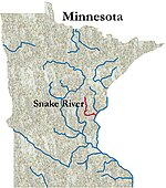
The Kettle is an 83.6-mile-long (134.5 km) tributary of the St. Croix River in eastern Minnesota in the United States. Via the St. Croix River, it is part of the watershed of the Mississippi River. The river's English name is due to the large number of large rounded holes (kettles) in the sandstone in and around the river, carved out by the swirling waters of the river. The river's Dakota name Céġa watpa entered into English via the Anishinaabe people's Akiko-ziibi, both meaning "Kettle River".

Excerpt from the Wikipedia article Kettle River (St. Croix River tributary) (License: CC BY-SA 3.0, Authors, Images).

Kettle River (St. Croix River tributary)
Town of West Marshland

Geographical coordinates (GPS) Address Nearby Places
placeShow on map

Wikipedia: Kettle River (St. Croix River tributary)Continue reading on Wikipedia

Geographical coordinates (GPS)

Latitude Longitude
N 45.8577304 ° E -92.7363141 °
placeShow on map

Address

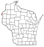
Town of West Marshland


Town of West Marshland
Wisconsin, United States
mapOpen on Google Maps

BanningStateParkMN arf (3)
Share experience

Nearby Places

Wood River (Wisconsin)

The Wood River is a 47.7-mile-long (76.8 km) tributary of the St. Croix River in western Burnett County, Wisconsin, United States. It follows a meandering course in a generally westward direction. Its banks are mostly low and marshy, though there are high sandbanks in places. Although it flows through a few communities, for most of its course it flows through relatively natural settings. Its source can be traced to Wood Creek which drains wetlands near the village of Frederic, Wisconsin in Polk County. Wood Creek runs through the unincorporated settlement of Falun, located in the town of Daniels, Burnett County, and eventually empties into Little Wood Lake. Little Wood Lake is drained by the Little Wood River which flows a few miles westward to Big Wood Lake, located in the town of Wood River. The Wood River proper begins at the north end of Big Wood Lake. It flows north several miles before it arcs back through the village of Grantsburg and on to the St. Croix River, several miles south of State Highway 70. In the Ojibwe language, this river was called Wiigobimizh-ziibi (Basswood River) because of the abundance of this tree, from which strips of softened inner bark were used as lashings or cording called wiigob. Because of the wetland complex through which the Wood River flows, the Ojibwe called the vicinity of the village of Grantsburg Gichi-Mashkiigiminakaaning (at the great place full of low-bush cranberries).