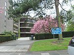
Houghall

Houghall [pron: /ˈhɒfl/] is a hamlet in County Durham, in England. It is situated approximately 1.5 miles (2.4 km) to the south of Durham city centre. It is also the location of the Houghall Campus of East Durham College, associated gardens, a small number of houses and a restaurant. Coal was mined from the Hutton seam in Houghall from 1840 and a colliery village built during the 1860s although many miners lived in nearby Shincliffe. Mining declined from the 1880s and the village was demolished in the 1950s, the area landscaped and turned over to picturesque woodland. The foundations of some mining houses still remain. In 2009, heavy rain at the Houghall site caused the River Wear to carve a massive trench through the grounds of the college, some 14 feet deep and 80 feet wide. This is thought to have been an old watercourse, created by monks to divert the river from Durham Cathedral. This has attracted much attention and so has been dubbed Durham's Grand Canyon.Houghall began hosting Durham Flower Festival on its campus in 2014.
Excerpt from the Wikipedia article Houghall (License: CC BY-SA 3.0, Authors, Images).Houghall
Houghall Discovery Trail, Durham City of Durham
Geographical coordinates (GPS) Address Nearby Places Show on map
Geographical coordinates (GPS)
| Latitude | Longitude |
|---|---|
| N 54.758333333333 ° | E -1.5633333333333 ° |
Address
3. The Pit Village
Houghall Discovery Trail
DH1 3SJ Durham, City of Durham
England, United Kingdom
Open on Google Maps


