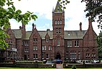
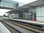
Allerton, Liverpool
Areas of LiverpoolOpenDomesday

Allerton is a suburb of Liverpool, England. Historically in Lancashire, it is located 3 miles (4.8 km) southeast of the city centre and is bordered by the suburbs of Garston, Hunt's Cross, Mossley Hill, and Woolton. It has a number of large houses in the prestigious Calderstones Park area, with mainly 1930s semi-detached housing around the shopping area of Allerton Road. It is paired with Hunts Cross to form the Allerton and Hunts Cross city council ward, which had a population of 14,853 at the 2011 census.
Excerpt from the Wikipedia article Allerton, Liverpool (License: CC BY-SA 3.0, Authors, Images).Allerton, Liverpool
Handlake Drive, Liverpool Allerton
Geographical coordinates (GPS) Address Nearby Places Show on map
Geographical coordinates (GPS)
| Latitude | Longitude |
|---|---|
| N 53.3685 ° | E -2.8934 ° |
Address
Handlake Drive
Handlake Drive
L19 4AF Liverpool, Allerton
England, United Kingdom
Open on Google Maps


