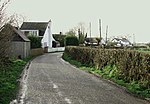
Ash, Derbyshire
Civil parishes in DerbyshireDerbyshire geography stubs

Ash is a small civil parish in the South Derbyshire district of Derbyshire, with a population of 98 (2001 census). The parish includes scattered hamlets and Ashe Hall, the Tara Buddhist Centre.
Excerpt from the Wikipedia article Ash, Derbyshire (License: CC BY-SA 3.0, Authors, Images).Ash, Derbyshire
Ash Lane, South Derbyshire Ash CP
Geographical coordinates (GPS) Address Nearby Places Show on map
Geographical coordinates (GPS)
| Latitude | Longitude |
|---|---|
| N 52.892 ° | E -1.62 ° |
Address
Ash Lane
Ash Lane
DE65 6HT South Derbyshire, Ash CP
England, United Kingdom
Open on Google Maps


