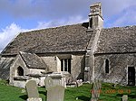
Ampney Crucis
Cotswold DistrictOpenDomesdayUse British English from October 2015Villages in Gloucestershire

Ampney Crucis is a village and civil parish in the Cotswolds, part of the Cotswold District of Gloucestershire, England. The village is in the Ampney-Coln electoral ward. This ward stretches from Ampney Crucis to Coln St. Dennis in the north. The total population of the ward at the 2011 census was 1,884.The Ampney Brook, a tributary of the River Thames, flows through the village, which is near the smaller villages of Ampney St Mary and Ampney St Peter, and about 3 miles (5 km) east of Cirencester.
Excerpt from the Wikipedia article Ampney Crucis (License: CC BY-SA 3.0, Authors, Images).Ampney Crucis
Church Lane, Cotswold District Ampney Crucis
Geographical coordinates (GPS) Address Nearby Places Show on map
Geographical coordinates (GPS)
| Latitude | Longitude |
|---|---|
| N 51.716 ° | E -1.907 ° |
Address
Church Lane
Church Lane
GL7 5RY Cotswold District, Ampney Crucis
England, United Kingdom
Open on Google Maps


