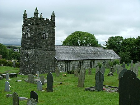
Warbstow

Warbstow (Cornish: Lannwarburgh) is a village and civil parish in Cornwall, England, United Kingdom. The parish has a population of 439 according to the 2001 census, increasing to 520 at the 2011 census.The parish is one of the few left in England to still have an exclave. The main body of the parish includes the villages of Warbstow, Warbstow Cross and Trelash and a number of hamlets, whereas the exclave (from which the main part is separated by about 150m) includes the hamlet of Canworthy Water. Both the neighbouring parish of Treneglos and Warbstow belonged in the 12th century to the Lords of Cardinham who donated them to the priory of Tywardreath. Warbstow was then a chapelry to Treneglos and the two benefices were later united as a vicarage. According to Charles Henderson, writing in 1925, "The presence ... of St Werburga ... is not easily accounted for (though the parish is famous for geese which figure in her legend)". At Youlstone an Iron Age bronze bowl was discovered in 1925. At Lower Youlton farm is a Cornish cross in use as a footbridge; it has undergone much wear from foot passengers and its original location is unknown.
Excerpt from the Wikipedia article Warbstow (License: CC BY-SA 3.0, Authors, Images).Warbstow
Bury Close,
Geographical coordinates (GPS) Address Nearby Places Show on map
Geographical coordinates (GPS)
| Latitude | Longitude |
|---|---|
| N 50.685 ° | E -4.542 ° |
Address
Bury Close
PL15 8UZ , Warbstow
England, United Kingdom
Open on Google Maps


