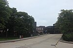
Oakland/Troy Airport
Oakland/Troy Airport (ICAO: KVLL, FAA LID: VLL) is a county-owned public-use airport located two miles (3.2 km) east of the central business district of Troy, a city in Oakland County, Michigan, United States. It is included in the Federal Aviation Administration (FAA) National Plan of Integrated Airport Systems for 2017–2021, in which it is categorized as a regional reliever airport facility.The Oakland/Troy Airport is considered the county's "executive" airport. Business travelers and tourists using private, corporate and charter aircraft benefit from the airport's convenient proximity to business, recreation and entertainment facilities. It is located between Maple Road and 14 Mile Road and Coolidge Highway and Crooks Road. Although most U.S. airports use the same three-letter location identifier for the FAA and IATA, Oakland/Troy Airport is assigned VLL by the FAA but has no designation from the IATA (which assigned VLL to Valladolid, Spain). Oakland/Troy was formerly designated 7D2 but changed March 17, 2005 after an automated weather station was installed at the field.
Excerpt from the Wikipedia article Oakland/Troy Airport (License: CC BY-SA 3.0, Authors).Oakland/Troy Airport
Equity Drive, Troy
Geographical coordinates (GPS) Address External links Nearby Places Show on map
Geographical coordinates (GPS)
| Latitude | Longitude |
|---|---|
| N 42.543055555556 ° | E -83.177777777778 ° |
Address
Oakland-Troy Airport
Equity Drive 2672
48084 Troy
Michigan, United States
Open on Google Maps


