Dolnji Kot
Jugovzhodna Slovenija statistical region geography stubsPages with Slovene IPAPopulated places in the Municipality of Žužemberk

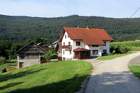
Dolnji Kot (pronounced [ˈdoːlnji ˈkoːt], German: Unterwinkel) is a settlement on the left bank of the Krka River in the Municipality of Žužemberk in southeastern Slovenia. The area is part of the historical region of Lower Carniola. The municipality is now included in the Southeast Slovenia Statistical Region.A roadside chapel-shrine in the northern part of the settlement was built in 1898.
Excerpt from the Wikipedia article Dolnji Kot (License: CC BY-SA 3.0, Authors, Images).Dolnji Kot
Geographical coordinates (GPS) Address Nearby Places Show on map
Geographical coordinates (GPS)
| Latitude | Longitude |
|---|---|
| N 45.793222222222 ° | E 14.977733333333 ° |
Address
8361
Slovenia
Open on Google Maps


