Gateshead Fell
EngvarB from September 2013Parks and open spaces in County Durham
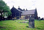
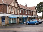
Gateshead Fell was a district in County Durham, England. It was located on the immediate border of the town of Gateshead, 2.3 miles from the city of Newcastle upon Tyne. Once described as a "dark, spongy moor", Gateshead Fell existed in some form for almost nine hundred years before it was enclosed in 1809 and divided into a number of villages, notably Sheriff Hill, Low Fell and Wrekenton, which were themselves absorbed by the urban expansion of Gateshead and were officially incorporated into the Metropolitan Borough of Gateshead with the passing of the Local Government Act in 1974.
Excerpt from the Wikipedia article Gateshead Fell (License: CC BY-SA 3.0, Authors).Gateshead Fell
Old Durham Road,
Geographical coordinates (GPS) Address Nearby Places Show on map
Geographical coordinates (GPS)
| Latitude | Longitude |
|---|---|
| N 54.934 ° | E -1.582 ° |
Address
Old Durham Road
Old Durham Road
NE9 6RQ , Wrekenton
England, United Kingdom
Open on Google Maps


