Hartwell, Cincinnati
Cincinnati stubsFormer municipalities in OhioNeighborhoods in Cincinnati

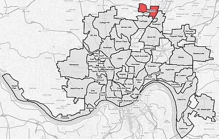
Hartwell is one of the 52 neighborhoods of Cincinnati, Ohio. Established in 1868 and annexed in 1912, it is the city's northernmost neighborhood, centered roughly on the intersections of I-75 and Ronald Reagan Cross County Highway. Its boundaries are a combination of Caldwell Park and Ronald Reagan Cross County Highway to the south, I-75 to the east, and a combination of Millsdale Street and Compton Road to the North. The population was 5,806 at the 2020 census.
Excerpt from the Wikipedia article Hartwell, Cincinnati (License: CC BY-SA 3.0, Authors, Images).Hartwell, Cincinnati
Vine Street, Cincinnati Hartwell
Geographical coordinates (GPS) Address Nearby Places Show on map
Geographical coordinates (GPS)
| Latitude | Longitude |
|---|---|
| N 39.211111111111 ° | E -84.475 ° |
Address
Vine Street
45216 Cincinnati, Hartwell
Ohio, United States
Open on Google Maps


