Øster Voldgade
Streets in Copenhagen

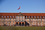
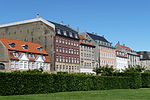
Øster Voldgade (lit. "East Rampart Street"), together with Vester Voldgade and Nørre Voldgade, forms a succession of large streets which arches around the central and oldest part of the Zealand side of Copenhagen, Denmark. It runs north-east from Gothersgade at Nørreport Station to Georg Brandes Plads, between the Copenhagen Botanical Gardens and Rosenborg Castle Gardens, and continues straight to a large junction at the southern end of Oslo Plads, near Østerport Station, where it turns into Folke Bernadotte Allé.
Excerpt from the Wikipedia article Øster Voldgade (License: CC BY-SA 3.0, Authors, Images).Øster Voldgade
Øster Voldgade, Copenhagen Indre By
Geographical coordinates (GPS) Address Nearby Places Show on map
Geographical coordinates (GPS)
| Latitude | Longitude |
|---|---|
| N 55.6867 ° | E 12.5769 ° |
Address
Øster Voldgade
Øster Voldgade
1307 Copenhagen, Indre By
Capital Region of Denmark, Denmark
Open on Google Maps


