place

The Centre, Bristol

Bristol HarboursideEngvarB from October 2013History of BristolParks and open spaces in Bristol
Northern end of The Centre, Bristol, March 2018

The Centre is a public open space in the central area of Bristol, England, created by covering over the River Frome. The northern end of The Centre, known as Magpie Park, is skirted on its western edge by Colston Avenue; the southern end is a larger paved area bounded by St Augustine's Parade to the west, Broad Quay the east, and St Augustine's Reach (part of the Floating Harbour) to the south, and bisected by the 2016 extension of Baldwin Street. The Centre is managed by Bristol City Council. The name 'The Centre' (or 'The City Centre') appears to have been applied to the area from the mid-twentieth century; before that, from 1893 when the upper part of St Augustine's reach was covered, it was known as the Tramways Centre and Magpie Park.The Centre is not the historic or civic centre of Bristol, nor is it a major shopping area. It is, however, an important local transport interchange and cultural destination. Many local bus services terminate at or pass through here, and it is also served by ferry services to Hotwells and Bristol Temple Meads station, and has busy taxi ranks. The Centre has been altered on a number of occasions, originally to ease traffic flow but latterly to try to strike a balance between its use as both public open space and an important traffic corridor. In 2017, alterations to accommodate the MetroBus bus rapid transit scheme were completed.

Excerpt from the Wikipedia article The Centre, Bristol (License: CC BY-SA 3.0, Authors, Images).

The Centre, Bristol
Centre Promenade, Bristol City Centre

Geographical coordinates (GPS) Address Website External links Nearby Places
placeShow on map

Wikipedia: The Centre, BristolContinue reading on Wikipedia

Geographical coordinates (GPS)

Latitude Longitude
N 51.454 ° E -2.5972 °
placeShow on map

Address

Centre Promenade

Centre Promenade
Bristol, City Centre
England, United Kingdom
mapOpen on Google Maps

Website
bristol.gov.uk

linkVisit website

linkWikiData (Q7721919)
linkOpenStreetMap (1381055)

Northern end of The Centre, Bristol, March 2018
Share experience

Nearby Places

Bristol
Bristol

Bristol ( (listen)) is a city, ceremonial county and unitary authority in England. Situated on the River Avon, it is bordered by the ceremonial counties of Gloucestershire to the north and Somerset to the south. Bristol is the most populous city in South West England. The wider Bristol Built-up Area is the eleventh most populous urban area in the United Kingdom.Iron Age hillforts and Roman villas were built near the confluence of the rivers Frome and Avon. Around the beginning of the 11th century, the settlement was known as Brycgstow (Old English: 'the place at the bridge'). Bristol received a royal charter in 1155 and was historically divided between Gloucestershire and Somerset until 1373 when it became a county corporate. From the 13th to the 18th century, Bristol was among the top three English cities, after London, in tax receipts. A major port, Bristol was a starting place for early voyages of exploration to the New World. On a ship out of Bristol in 1497, John Cabot, a Venetian, became the first European to land on mainland North America. In 1499, William Weston, a Bristol merchant, was the first Englishman to lead an exploration to North America. At the height of the Bristol slave trade, from 1700 to 1807, more than 2,000 slave ships carried an estimated 500,000 people from Africa to slavery in the Americas. The Port of Bristol has since moved from Bristol Harbour in the city centre to the Severn Estuary at Avonmouth and Royal Portbury Dock. Bristol's modern economy is built on the creative media, electronics and aerospace industries; the city-centre docks have been redeveloped as centres of heritage and culture. The city has the largest circulating community currency in the UK, the Bristol Pound, which is pegged to the pound sterling. The city has two universities: the University of Bristol and the University of the West of England (UWE Bristol). There are a variety of artistic and sporting organisations and venues including the Royal West of England Academy, the Arnolfini, Spike Island, Ashton Gate and the Memorial Stadium. It is connected to London and other major UK cities by road and rail, and to the world by sea and air: road, by the M5 and M4 (which connect to the city centre by the Portway and M32); rail, via Bristol Temple Meads and Bristol Parkway mainline rail stations; and Bristol Airport. Bristol was named the best city in Britain in which to live in 2014 and 2017; it won the European Green Capital Award in 2015.

Bristol Beacon
Bristol Beacon

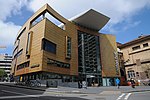
Bristol Beacon, previously known as Colston Hall, is a concert hall and Grade II listed building on Colston Street, Bristol, England. It is owned by Bristol City Council. Since 2011, management of the hall has been the direct responsibility of Bristol Music Trust. The hall opened as a concert venue in 1867, and became a popular place for classical music and theatre. In the mid-20th century, wrestling matches were in strong demand, while in the late 1960s it developed into one of the most important rock music venues in Britain. The hall has been redeveloped several times, and was gutted by fires in 1898 and 1945, though the original Bristol Byzantine foyer has survived. A major refurbishment, adding an extra wing, opened in 2009. The hall's official capacity is 2,075, with an additional 350 in "The Lantern", built as part of the 2009 redevelopments. As well as the main entertainment areas, there are a number of licensed bars and a restaurant. The hall was formerly named after the slave trader, merchant and philanthropist Edward Colston, who founded Colston's School on the site in the early 18th century. The decision to rename was taken in 2017 to coincide with a major redevelopment of the venue, after a number of years' debates and campaigns regarding Colston's ties to the Atlantic slave trade. The renaming was brought forward in September 2020 following anti-racism protests in Bristol that summer.The hall has been closed since 2018 for repair and refurbishment work, and is expected to reopen in late 2023.

Lloyds Bank, Bristol

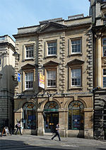
The Lloyds Bank (grid reference ST587729) is an historic building situated at 53 & 55 Corn Street in Bristol, England. Originally the West of England and South Wales Bank built by Bristol architects William Bruce Gingell (1819–1899) and T.R. Lysaght in 1854. Gingell was one of the most progressive Bristol architects of the latter part of the nineteenth century. He went on to design the General Hospital. Gingell is said to have used St Mark's library in Venice as a starting point for this building. The sumptuous friezes by are by John Thomas (1813–1862). John Thomas had been responsible for overseeing the carving on Charles Barry's new Houses of Parliament. On the ground floor the crests of Newport, Bath, Bristol, Exeter, and Cardiff are shown – the main towns from where the bank operated. On the first floor the ‘elements and sources of wealth’ are symbolised by life-size figures. They include: justice and integrity; education and charity; peace and plenty; art and science; commerce, navigation and commerce. And above this chubby cherubs depict the activities of the bank: receiving, paying, storing, coining money, engraving and printing, and trading with Africa and America. The adornment was intended to emphasize the wealth, and therefore financial stability, of the bank. It didn't stop the bank going bust, however, twenty years later in 1878. The opulent interior features Corinthian columns.It is a grade II* listed building and formerly housed a branch of the Lloyds Bank.It is now a 42-room boutique hotel & luxury spa.