place

Rock FM (Lancashire)

1982 establishments in EnglandBauer RadioContemporary hit radio stations in the United KingdomHits RadioMass media in Preston
Radio stations established in 1982Radio stations in LancashireUse British English from February 2016

Rock FM is an Independent Local Radio station based in Liverpool, England, owned and operated by Bauer as part of the Hits Radio network. It broadcasts to Lancashire, North West England. As of December 2023, the station has a weekly audience of 212,000 listeners according to RAJAR.

Excerpt from the Wikipedia article Rock FM (Lancashire) (License: CC BY-SA 3.0, Authors).

Rock FM (Lancashire)
Alston Lane, Ribble Valley Longridge

Geographical coordinates (GPS) Address Nearby Places
placeShow on map

Wikipedia: Rock FM (Lancashire)Continue reading on Wikipedia

Geographical coordinates (GPS)

Latitude Longitude
N 53.8 ° E -2.6 °
placeShow on map

Address

Alston Lane
PR3 3BN Ribble Valley, Longridge
England, United Kingdom
mapOpen on Google Maps

Share experience

Nearby Places

Lancashire
Lancashire

Lancashire ( LAN-kə-shər, -⁠sheer; abbreviated Lancs) is a ceremonial county in North West England. It is bordered by Cumbria to the north, North Yorkshire and West Yorkshire to the east, Greater Manchester and Merseyside to the south, and the Irish Sea to the west. The largest settlement is Blackpool, and the county town is the city of Preston.The county has an area of 3,079 square kilometres (1,189 sq mi) and a population of 1,490,300. After Blackpool (149,070), the largest settlements are Blackburn (124,995) and the city of Preston (94,490); the city of Lancaster has a population of 52,655. For local government purposes, Lancashire comprises a non-metropolitan county, with twelve districts, and two unitary authority areas, Blackburn with Darwen and Blackpool. The county historically included northern Greater Manchester and Merseyside, the Furness and Cartmel peninsulas of Cumbria, and some of northern Cheshire, and excluded the eastern part of the Forest of Bowland. The west of Lancashire contains flat coastal plains, which rise to the hills of the Pennines in the east. The county contains large parts of two national landscapes, Arnside and Silverdale and the Forest of Bowland, and other protected areas such as the Ribble and Alt Estuaries National nature reserve. The major rivers in the county are, from north to south, the Lune, the Wyre, and the Ribble, which all flow west into the Irish Sea. The highest point in Lancashire is either Gragareth or Green Hill, both approximately 628 m (2,060 ft) high and located in the far north-east of the county. Lancashire was founded in the 12th century; in the Domesday Book of 1086 much of what would become the county is treated as part of Yorkshire and Cheshire. Until the Early Modern period the county was a comparatively poor backwater, although in 1351 it became a palatine, with a semi-independent judicial system. This changed during the Industrial Revolution, when the county rapidly industrialised; until 1974 it included both Liverpool, a major port, and Manchester, which with its surrounding towns dominated the manufacture of textiles. The Lancashire coalfield was also exploited, with many collieries opening. By 1971 Lancashire had a population of 5,118,405, which made it the most heavily populated county in the United Kingdom after Greater London.

Grimsargh railway station

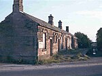
Grimsargh railway station was on the single track Preston and Longridge Railway. It served the village of Grimsargh in Lancashire, England. When the line first opened in 1840, wagons carrying quarried stone ran downhill from Longridge to Preston and were hauled in the other direction by horses. There were rudimentary passenger facilities at Grimsargh — the nearby Plough Hotel was used as a booking office. It was not until 1870 that a proper station building was constructed, when the line was run jointly by the Lancashire and Yorkshire Railway and the London and North Western Railway.In 1889, the privately run Whittingham Hospital Railway was opened to a second Grimsargh Station which was diagonally opposite the level crossing from the main station. This station had a run-around loop and a connection with the Longridge line facing in the direction of Longridge. Two sidings were also provided. On a single short platform, the station building comprised an open fronted shed of brick and wood with an overall roof and canopy. The building was some 40 ft (12 m) in length by 12 ft (3.6 m) wide with a 10 ft (3 m) waiting room at the Longridge end. Hospital trains were timed to connect with trains to and from Preston.The Longridge-to-Preston line closed to passengers in 1930, but the hospital line continued to be used until 1957 when its single steam locomotive was condemned. The Longridge line's goods service was finally withdrawn in 1967. The station's buildings were demolished in the late 1970s and houses built on the site, the new houses following the alignment of the former station buildings.

Longridge railway station (England)

Longridge railway station was a passenger terminus of the Preston and Longridge Railway. It served the town of Longridge in Lancashire, England. The line first opened in 1840 to carry stone from the recently opened Tootle Heights quarry on the northeastern side of the village of Longridge, as it then was. Wagons carrying quarried stone ran downhill to Preston and were hauled in the other direction by horses. There were rudimentary passenger facilities at a level crossing in Burey Lane (later called Berry Lane) which at the time was a rural lane with only a couple of houses; the village of Longridge was at the southeast end of the lane. A hotel was built next to the station, and was known as the Longridge Railway Tavern and the Station Hotel before being renamed in 1853 the Towneley Arms, as it is still known today.After the railway converted to steam power in 1848, Longridge expanded rapidly. Four cotton mills were built alongside the railway and Berry Lane became the town centre.By 1867, the railway was owned jointly by the Lancashire and Yorkshire Railway and the London and North Western Railway, and three years later the railway bought the Towneley Arms. A station building was built on the side of the hotel in 1872.On the opposite side of Berry Lane were many goods sidings, for the local mills, gasworks and a coal merchant. The line continued to the Tootle Heights quarries. The line and the station closed to passengers on 31 May 1930. Goods traffic continued until November 1967; within the next year the tracks were lifted.Today the former station building and canopy still exist and are used as the headquarters of Longridge Town Council. Where the tracks once ran through the station is a war memorial, erected in 1981. Part of the goods yard opposite has become a supermarket car park.In late 2008, a Heritage Lottery Fund grant of £221,600 was awarded to restore the former station building for use as a heritage centre and community area. The restoration was completed in 2010.