Point Richmond, Richmond, California
Neighborhoods in Richmond, CaliforniaPopulated coastal places in California

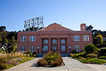
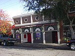
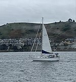
Point Richmond, also sometimes referred to locally as The Point, is a neighborhood in Richmond, California, United States, near the eastern end of the Richmond-San Rafael Bridge, between Interstate 580 and the San Francisco Bay.
Excerpt from the Wikipedia article Point Richmond, Richmond, California (License: CC BY-SA 3.0, Authors, Images).Point Richmond, Richmond, California
Bishop Avenue, Richmond
Geographical coordinates (GPS) Address Nearby Places Show on map
Geographical coordinates (GPS)
| Latitude | Longitude |
|---|---|
| N 37.924166666667 ° | E -122.38916666667 ° |
Address
Bishop Avenue 261
94801 Richmond
California, United States
Open on Google Maps


