Houma Air Force Station
1955 establishments in Louisiana1970 disestablishments in LouisianaAerospace Defense Command military installationsBuildings and structures in Terrebonne Parish, LouisianaGeographic coordinate lists ... and 6 more
Installations of the United States Air Force in LouisianaLists of coordinatesMilitary installations closed in 1970Military installations established in 1955Semi-Automatic Ground Environment sitesUse American English from January 2024
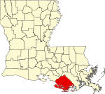
Houma Air Force Station (ADC ID: M-126 NORAD ID: Z-126) is a closed United States Air Force General Surveillance Radar station. It is located 3.5 miles (5.6 km) southeast Houma, Louisiana. It was closed in 1970.
Excerpt from the Wikipedia article Houma Air Force Station (License: CC BY-SA 3.0, Authors).Houma Air Force Station
Sayre Road,
Geographical coordinates (GPS) Address Nearby Places Show on map
 Continue reading on Wikipedia
 Geographical coordinates (GPS)
| Latitude | Longitude |
|---|---|
| N 29.5625 ° | E -90.675 ° |
Address
Terrebonne Career and Technical High School
Sayre Road
70363
Louisiana, United States
Open on Google Maps