place

Drws-y-Nant

Brithdir and LlanfachrethVillages in GwyneddWales geography stubs
Old Station House at Drws y Nant seen across a new section of the A494 geograph.org.uk 476111

Drws-y-Nant is a village in Gwynedd, Wales. It was formerly served by the Drws-y-Nant railway station but this closed in 1965.

Excerpt from the Wikipedia article Drws-y-Nant (License: CC BY-SA 3.0, Authors, Images).

Geographical coordinates (GPS)

Latitude Longitude
N 52.789 ° E -3.756 °
placeShow on map

Address


LL40 2BE , Brithdir and Llanfachreth
Wales, United Kingdom
mapOpen on Google Maps

Old Station House at Drws y Nant seen across a new section of the A494 geograph.org.uk 476111
Share experience

Nearby Places

Afon Mawddach
Afon Mawddach

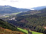
The Afon Mawddach (English: River Mawddach) is a river in Gwynedd, Wales, which has its source in a wide area SH820300 north of Dduallt in Snowdonia. It is 28 miles (45 km) in length, and is much branched; many of the significant tributaries are of a similar size to the main river. The catchment area is bounded to the east by the Aran Fawddwy massif and to the west and north by the Harlech dome which forms a watershed just south of Llyn Trawsfynydd. The Mawddach has been the site of significant industrialisation and land management. Gold mining and subsequently gold panning have had major impacts but forestry, the preparation of animal skins, the storage of old munitions and the use of hill-sides as artillery ranges have all added to the legacy of pollution. The river is also very flashy - prone to very rapid rise and fall in level depending on rainfall. Rainfall can also be very heavy and it falls on very base-poor soils leading to episodes of strongly depressed pH. Despite this, the river sustains an important salmon and trout fishery and the countryside through which it flows is some of the most spectacular and scenic in the UK. The main tributaries starting in the west and working clockwise are: Afon Cwm Mynach which drains Llyn Cwm Mynach on the Rhinogydd. Afon Gamlan which joins at Ganllwyd after following a tumultuous valley through ancient oak woods before descending towards the main river down Rhaeadr Ddu (Black waterfalls). This valley has one of the more important moss and liverwort communities in the southern UK. Afon Eden - its headwaters known as Afon Crawcwellt - a large tributary draining from below Llyn Trawsfynydd and closely following the A470 through the Coed-y-Brenin forest. This tributary has been severely affected by industrialisation in the past, including gold mining and its use as an ordnance range. Afon Gain, a large tributary which has also been impacted by similar problems to the Eden and is very acidic and peaty. Afon Wen which joins south of the Gain is similar but smaller. Afon Wnion is a major tributary joining from the east and which drains a large area out towards Aran Fawddwy

Maesglase
Maesglase

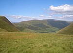
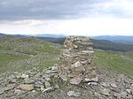
Maesglase is a mountain in Snowdonia, North Wales, situated approximately four miles to the south-west of Aran Fawddwy. It is the highest of the Dyfi Hills.It can be reached by an easy but steep walk through the forestry from Dinas Mawddwy or directly from the bwlch on the A470. Ascending Maesglase provides an opportunity to climb several other nearby peaks including Maen-Du, Craig Rhiw-erch, Waun-oer, Craig Portas and Cribin Fawr which are linked by a series of ridges and arêtes. The precise location of the summit is the subject of some confusion. Traditionally, the top of Maen Du (674 metres (2,211 ft) at SH823152) was regarded as Maesglase's summit. However, more recent surveys suggest that the top of Craig Rhiw-erch (c 676 metres (2,218 ft) at SH817150, some 600 metres (2,000 ft) to the west) is higher. A recent survey puts it at 678.5 metres (2,226 ft). The geomorphology of these mountains is classical U-shaped glacial valleys with textbook examples of hanging valleys and intersecting valleys. The eastern slopes are devoted to sheep farming whilst the western slopes are intensively forested. Above the semi-improved grassland is some bracken but much of the higher ground is covered in typical Calluna / Erica communities interspersed with large areas of Juncus, Carex and Sphagnum bogs. The tops of Cribin Fawr are flat expanses of peat-hags. On the eastern flanks Bilberry (Vaccinium myrtillus) grows in abundance with Cowberry (Vaccinium vitis-idaea) common on the highest ground. Half a mile to the west of the peak of Cribin Fawr at a high point of 659 metres (2,162 ft) is a stone boundary marker dated 1861 and inscribed CCC and bearing a benchmark. Maesglase waterfall has a total height of 160 metres (520 ft). To the south lie the parallel ridges leading to Mynydd Dolgoed and Mynydd Gartheiniog. The site is the location of the Welsh-language novel O! Tyn y Gorchudd! by Angharad Price.