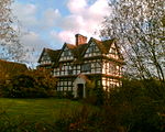
Feckenham Forest

Feckenham Forest was a royal forest, centred on the village of Feckenham, covering large parts of Worcestershire and west Warwickshire. It was not entirely wooded, nor entirely the property of the King. Rather, the King had legal rights over game, wood and grazing within the forest, and special courts imposed harsh penalties when these rights were violated. Courts and the forest gaol were located at Feckenham and executions took place at Gallows Green near Hanbury. The legal origins are not recorded, but the area may have been used by Edward the Confessor and his predecessors for hunting. Large areas of Worcestershire were subject to forest law at the time of the Domesday Book. Forest law itself evolved greatly in the early Norman period. The forest boundaries were extended greatly during the reign of Henry II, expanding from 34 to 184 square miles. The forest boundaries were reduced back in 1301. The wood was encroached to produce salt in Droitwich, and was quite reduced by the time it was disafforested during the reign of King Charles I in 1629. The process of disafforestation created considerable social unrest and riots. A few areas of ancient forest still remain near Dodford and Chaddesley Corbett. The underlying geology of the forest area is mostly clay or sands and gravels. There are also peatland bogs to the south of Feckenham.
Excerpt from the Wikipedia article Feckenham Forest (License: CC BY-SA 3.0, Authors, Images).Feckenham Forest
Flying Horse Lane, Wychavon Stock and Bradley
Geographical coordinates (GPS) Address Nearby Places Show on map
Geographical coordinates (GPS)
| Latitude | Longitude |
|---|---|
| N 52.26 ° | E -2.02 ° |
Address
Flying Horse Lane
Flying Horse Lane
B96 6QT Wychavon, Stock and Bradley
England, United Kingdom
Open on Google Maps


