Custer Air Force Station
1952 establishments in Michigan1969 disestablishments in MichiganAerospace Defense Command military installationsGeographic coordinate listsInstallations of the United States Air Force in Michigan ... and 5 more
Lists of coordinatesMilitary installations closed in 1969Military installations established in 1952Radar stations of the United States Air ForceUse American English from January 2024

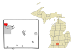
Custer Air Force Station (ADC ID: P-67 DC-6, NORAD ID: Z-67, DC-6) is a closed United States Air Force General Surveillance Radar and Direction Center station. It is located 5.3 miles (8.5 km) west-northwest of Battle Creek, Michigan. It was closed in 1969.
Excerpt from the Wikipedia article Custer Air Force Station (License: CC BY-SA 3.0, Authors, Images).Custer Air Force Station
Brydges Drive, Battle Creek
Geographical coordinates (GPS) Address Nearby Places Show on map
Geographical coordinates (GPS)
| Latitude | Longitude |
|---|---|
| N 42.342222222222 ° | E -85.280277777778 ° |
Address
Brydges Drive
Brydges Drive
49037 Battle Creek
Michigan, United States
Open on Google Maps


