Cerovec, Šentjur
Pages with Slovene IPAPopulated places in the Municipality of ŠentjurŠentjur geography stubs
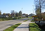
Cerovec (pronounced [ˈtseːɾɔʋəts]) is a settlement in the Municipality of Šentjur, in eastern Slovenia. It lies 10 km east of Celje and the A1 motorway crosses the settlement's territory. The settlement, and the entire municipality, are included in the Savinja Statistical Region, which is in the Slovenian portion of the historical Duchy of Styria. A hidden underground structure in the Šohta Woods near the settlement, built in 1944, was used as a secret Partisan hospital (Slovene: partizanska bolnišnica Zima).
Excerpt from the Wikipedia article Cerovec, Šentjur (License: CC BY-SA 3.0, Authors).Cerovec, Šentjur
Cerovec,
Geographical coordinates (GPS) Address Nearby Places Show on map
Geographical coordinates (GPS)
| Latitude | Longitude |
|---|---|
| N 46.251441666667 ° | E 15.360947222222 ° |
Address
Cerovec 9
3230
Slovenia
Open on Google Maps


