Sumas Prairie
British Columbia Coast geography stubsLandforms of British ColumbiaLandforms of Whatcom County, WashingtonLower Mainland
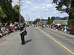
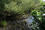
Sumas Prairie is a landform in British Columbia, Canada and the State of Washington, United States. Part of the Fraser Lowland, it was created by the draining of Sumas Lake early in the 20th Century, and extends from the Vedder Canal southwestwards into northern Whatcom County, Washington. The British Columbia Highway 1 traverses the former lakebed on the prairie between Abbotsford and Chilliwack.All of its Canadian portion, except its northeasternmost area around Yarrow, which is part of today's City of Chilliwack, was formerly the District of Sumas, which was amalgamated into the City of Abbotsford in 1972.
Excerpt from the Wikipedia article Sumas Prairie (License: CC BY-SA 3.0, Authors).Sumas Prairie
Campbell Road, Abbotsford
Geographical coordinates (GPS) Address Nearby Places Show on map
Geographical coordinates (GPS)
| Latitude | Longitude |
|---|---|
| N 49.05 ° | E -122.13333333333 ° |
Address
Campbell Road
Campbell Road
V3G 2G6 Abbotsford
British Columbia, Canada
Open on Google Maps


