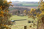
Dura Den
Canyons and gorges of ScotlandFife geography stubsForests and woodlands of ScotlandGeography of FifeLandforms of Fife

Dura Den is a small, 3 km-long wooded gorge that is located near Cupar in northeastern Fife, Scotland. This narrow cleft follows a course between the villages of Kemback to the north and Pitscottie to the south. A small stream, named the Ceres (or Kame) Burn, follows the course of this gorge and this flow includes small waterfalls near the midpoint. Historically the Ceres Burn was used to power jute spinning mills Around 1859, the geologist and Newburgh minister John Anderson discovered what turned out to be extensive sandstone deposits of ganoid fossilized fish in this area. The Dura Den Wood occupies an area of 4.25 acres (17,200 m2). The woods include ash, oak, and hazel.
Excerpt from the Wikipedia article Dura Den (License: CC BY-SA 3.0, Authors, Images).Dura Den
Geographical coordinates (GPS) Address Nearby Places Show on map
Geographical coordinates (GPS)
| Latitude | Longitude |
|---|---|
| N 56.31159 ° | E -2.94382 ° |
Address
KY15 5TJ
Scotland, United Kingdom
Open on Google Maps


