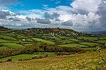
Ryall, Dorset
Dorset geography stubsVillages in Dorset

Ryall is a small village in the county of Dorset, on the south coast of Great Britain. It is situated roughly midway between the towns of Bridport and Lyme Regis, with the county town of Dorchester about 20 miles to the east. The village lies on the northern slopes of Hardown Hill, about 2 miles inland from the Jurassic Coast World Heritage Site. To the north the village looks across the Marshwood Vale towards a line of hills including Pilsdon Pen. Ryall is the home of 200 people.
Excerpt from the Wikipedia article Ryall, Dorset (License: CC BY-SA 3.0, Authors, Images).Ryall, Dorset
Ryall Road,
Geographical coordinates (GPS) Address Nearby Places Show on map
Geographical coordinates (GPS)
| Latitude | Longitude |
|---|---|
| N 50.751 ° | E -2.8429 ° |
Address
Ryall Road
Ryall Road
DT6 6EH , Whitchurch Canonicorum
England, United Kingdom
Open on Google Maps


