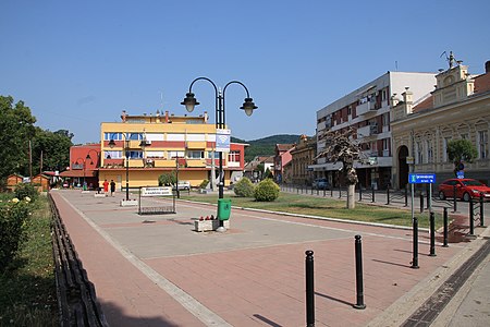
Golubac
Municipalities and cities of Southern and Eastern SerbiaPages with Serbo-Croatian IPAPopulated places in Braničevo District

Golubac (Serbian Cyrillic: Голубац, pronounced [ɡǒlubats]; Romanian: Golubăț) is a village and municipality located in the Braničevo District of eastern Serbia. Situated on the right side of the Danube river, it is bordered by Romania to the east, Veliko Gradište to the west and Kučevo to the south. The population of the village is 1,655 and the population of the municipality is 8,331. Due to many nearby archeological sites and the Đerdap national park, the village is a popular tourist, fishing and sailing destination.
Excerpt from the Wikipedia article Golubac (License: CC BY-SA 3.0, Authors, Images).Golubac
Duke Stepa, Golubac Municipality
Geographical coordinates (GPS) Address Nearby Places Show on map
Geographical coordinates (GPS)
| Latitude | Longitude |
|---|---|
| N 44.65 ° | E 21.633333333333 ° |
Address
Duke Stepa 1
12223 Golubac Municipality
Central Serbia, Serbia
Open on Google Maps

