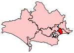
Westbourne, Dorset
Areas of BournemouthConservation areas in Dorset

Westbourne is a residential and shopping area of Bournemouth, Dorset, England. It is located in between Branksome, Poole and the centre of Bournemouth, just off the A338. Poole Road, mainly full of specialised shops and small cafes, runs through the centre of Westbourne with Seamoor Road curving round bringing more shops and services. Many of the shops have residential property above them.
Excerpt from the Wikipedia article Westbourne, Dorset (License: CC BY-SA 3.0, Authors, Images).Westbourne, Dorset
Portarlington Road,
Geographical coordinates (GPS) Address Nearby Places Show on map
Geographical coordinates (GPS)
| Latitude | Longitude |
|---|---|
| N 50.719 ° | E -1.898 ° |
Address
Beau Court
Portarlington Road 17
BH4 8BL , Westbourne
England, United Kingdom
Open on Google Maps


