Erpeldange

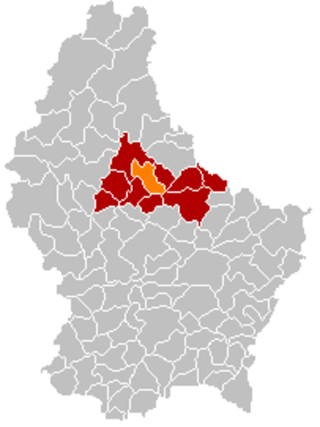
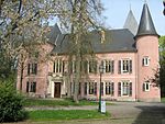
Erpeldange-sur-Sûre (Luxembourgish: Ierpeldeng op der Sauer [ˈiːɐ̯pəldeŋ op dɐ ˈzɑʊɐ], German: Erpeldingen an der Sauer [ˈɛʁpl̩dɪŋən ʔan deːɐ̯ ˈzaʊɐ]) is a commune and small town in north-eastern Luxembourg. It lies along the river Sûre, between Ettelbruck and Diekirch. It is part of the canton of Diekirch. As of 2001, the town of Erpeldange, which lies in the centre of the commune, has a population of 818. Other towns within the commune include Burden and Ingeldorf Erpeldange-sur-Sûre was formed on 1 July 1850, when it was detached from the commune of Ettelbruck, along with the commune of Schieren. The law forming Erpeldange-sur-Sûre was passed on the 22 January 1850.Erpeldange Castle now houses the commune's administrative offices. It has a history dating from the 13th century.
Excerpt from the Wikipedia article Erpeldange (License: CC BY-SA 3.0, Authors, Images).Erpeldange
Rue du Cimetière,
Geographical coordinates (GPS) Address Nearby Places Show on map
Geographical coordinates (GPS)
| Latitude | Longitude |
|---|---|
| N 49.8639 ° | E 6.1139 ° |
Address
Rue du Cimetière
9146
Luxembourg
Open on Google Maps


