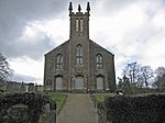
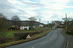
Caputh, Perth and Kinross
Perth and Kinross geography stubsUse British English from March 2017Villages in Perth and Kinross

Caputh ( KAY-pəth) is a parish and village in Perth and Kinross, Scotland. It lies on the A984 Coupar Angus to Dunkeld road about 6 miles (10 kilometres) southeast of Dunkeld and 8 miles (13 kilometres) west of Coupar Angus.It stands on the River Tay.The parish includes the East Cult standing stones.A 120m wide cairn, known as Cairnmore, was removed to facilitate farming in the 19th century. Remains of an important Roman fort still exist nearby at Inchtuthill. Cleaven Dyke is near Meikleour in the same Parish and was long-thought to be Roman too, but is now regarded as being a substantial Neolithic cursus.Dunkeld was partly in Caputh parish until 1891.
Excerpt from the Wikipedia article Caputh, Perth and Kinross (License: CC BY-SA 3.0, Authors, Images).Caputh, Perth and Kinross
Manse Road,
Geographical coordinates (GPS) Address Nearby Places Show on map
Geographical coordinates (GPS)
| Latitude | Longitude |
|---|---|
| N 56.543115 ° | E -3.484786 ° |
Address
Manse Road
Manse Road
PH1 4JQ
Scotland, United Kingdom
Open on Google Maps


