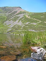
Buttermere and Ennerdale
Cumbria geography stubsNational Trust properties in the Lake District
Buttermere and Ennerdale is a National Trust property located in the Lake District of Cumbria, England. The property comprises an area of 8,866 acres (35.88 km2) of fell and common land, including the lakes of Buttermere, Crummock Water and Loweswater, seven farms and woodland, as well as access to Ennerdale Water.
Excerpt from the Wikipedia article Buttermere and Ennerdale (License: CC BY-SA 3.0, Authors).Buttermere and Ennerdale
Nine Becks Walk,
Geographical coordinates (GPS) Address Nearby Places Show on map
Geographical coordinates (GPS)
| Latitude | Longitude |
|---|---|
| N 54.54 ° | E -3.334 ° |
Address
Gale Fell Iron Mine
Nine Becks Walk
CA23 3AU , Ennerdale and Kinniside
England, United Kingdom
Open on Google Maps


