place

Litton, Derbyshire

Derbyshire DalesDerbyshire geography stubsTowns and villages of the Peak DistrictVillages in Derbyshire
Litton well dressing 002924 391f1a93

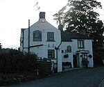
Litton is a village and civil parish in the Peak District of Derbyshire, England. The population at the 2011 Census was 675 (including Cressbrook (within the parish) and the separate parish of Little Longstone). It is one mile from Tideswell and six miles from Bakewell.The village has a primary school, a public house (the Red Lion) and a post office run by a co-operative of villagers. There are two churches, one at the east end of the village, and Christ Church at the west, on the outskirts of the village on the road to Tideswell. Litton has a well dressing each summer. The display is set on a base of moist clay and the patterns formed from petals, seeds, mosses and lichens.

Excerpt from the Wikipedia article Litton, Derbyshire (License: CC BY-SA 3.0, Authors, Images).

Litton, Derbyshire
Church Lane, Derbyshire Dales

Geographical coordinates (GPS) Address Phone number Website Nearby Places
placeShow on map

Wikipedia: Litton, DerbyshireContinue reading on Wikipedia

Geographical coordinates (GPS)

Latitude Longitude
N 53.274 ° E -1.756 °
placeShow on map

Address

Litton CofE Primary School

Church Lane
SK17 8QU Derbyshire Dales
England, United Kingdom
mapOpen on Google Maps

Phone number

call+441298871449

Website
littonprimary.co.uk

linkVisit website

Litton well dressing 002924 391f1a93
Share experience

Nearby Places

Cressbrook
Cressbrook

Cressbrook is a village in the Peak District National Park in Derbyshire. It lies in Water-cum-Jolly Dale at the foot of Cressbrook Dale. Population details at the 2011 Census are included in the civil parish of Litton. Before its Enclosure Act of 1762 Cressbrook did not exist. It later grew up around a textile mill complex built alongside the River Wye, first by Richard Arkwright and then later by his son Richard, JL Philips and Brother Cotton Spinners and McConnel and Company. Until McConnel's period of ownership the village did not exist beyond a collection of buildings in the immediate vicinity of the mill. When McConnel's workforce objected to the quality of the housing available he took it upon himself to build the model village that became Cressbrook. Building started in the late 1830s and was later extended by Henry McConnel's daughter, Mary Worthington, in 1902 to include a village club, modelled on a working men's club. Cressbrook Mill went bankrupt in 1965, after which time it changed from being a private mill estate to the public village that it now is. The Monsal Trail passes Cressbrook Mill. This 8.5-mile (13.7-kilometre) walk and cycleway mostly follows the old trackbed of the Manchester, Buxton, Matlock and Midlands Junction Railway where, from 1866 to 1959, the village of Cressbrook was served by Monsal Dale railway station. Until May 2011 the Cressbrook Tunnel (and others) were closed to walkers and cyclists for safety reasons and the Trail diverted across the River Wye next to the Mill. David Cannon McConnel emigrated to Queensland, Australia in 1840. In 1841, he established the Cressbrook Homestead named after their home town. The homestead in turn gives its name to the modern-day localities of Cressbrook, Queensland and Lower Cressbrook, Queensland.

Litton Mill
Litton Mill

Litton Mill is a textile mill at Millers Dale, near Tideswell in Derbyshire. The original 19th-century mill became notorious during the Industrial Revolution for its unsavoury employment practices, luridly described by the commentators of the day, and the testimony of Robert Blincoe, a parish apprentice who had been indentured to work at the mill. It was set up in 1782 by Ellis Needham and Thomas Frith, both farmers with small estates in the area. The mill was powered by the water of the River Wye, using Richard Arkwright's water frame. It could be said that the company was doomed from the start. Needham, in particular, had sunk most of his assets into the venture. The valley was particularly isolated and transport for the raw material and finished goods was poor. Moreover, they had difficulty in attracting a workforce. The early spinners, such as Arkwright and Strutt, had been able to attract the families of weavers and framework knitters, so-called "free labour" meaning the employees were not indentured. Meanwhile, Evans at Darley Abbey could draw on a pool of labour from the town of Derby. In contrast, the area around Litton was sparsely populated by farming people who were scornful of the new cotton industry. By 1786 the, barely profitable, mill was put up for sale. There were no buyers and Needham and Frith struggled on. Needham's money had gone and he was farming on rented land, while Frith left the partnership in 1799. The Poor Relief Act 1601 had, among its provisions "the putting out of children to be apprentices". An agreement was made between the churchwarden and an employer, by means of an indenture sworn before a Justice of the Peace, that the latter would provide for and give employment and training to a pauper child. Often this worked for the benefit of the child but often it was seen by employers as a source of cheap labour and a way for a parish to relieve itself of responsibility. In the absence of any local labour, this was the course taken by Needham and Frith. In the early 19th century there was a general depression in the industry, and the workforce was reduced by a half. There was a serious fire, and in 1811 the waterwheel broke and was out of action for a month. By 1815, Needham was bankrupt and had been given notice to quit. By 1828 he was a pauper. Frith fared somewhat better on his farm, and operating a small spinning mill near Tideswell. The mill was operated for a time by the Newtons of Cressbrook Mill but was destroyed by another fire in 1874. Very little remains of the original mill. Its replacement manufactures nylon yarn for hosiery. In 1893 Mr Matthew Dickie, a former Stockport mill owner, bought Litton Mill. Dickie began his business career as a spinner and manufacturer with his father Matthew Dickie Senior. When he took over Litton Mill he brought with him several families from Stockport. He set up a Litton & Cressbrook Mills Company and Cressbrook Mill was taken over. To bring the two mills into closer touch, a road was made along the river by the Company and a toll in aid of local hospitals was charged for visitors who wished to use the road. This shortened the distance to Monsal Dale. Litton Mill was sold to a syndicate in 1934. Matthew Dickie had Ravenstor built in Miller's Dale as his family residence which was given to the National Trust in 1937 by Alderman J.G.Graves of Sheffield along with 64 acres (260,000 m2) of land, which included a one-mile (1.6 km) stretch of the River Wye and Tideswell Dale, all of which are leased to the Youth Hostel Association and open all year round.

Tideswell Dale
Tideswell Dale

Tideswell Dale is a short dry limestone valley near Tideswell village, Derbyshire, in the Peak District of England. There is a farmland plateau on either side. The foot of the valley leads into Miller's Dale on the River Wye, which the valley's Brook Head stream runs into.The Carboniferous limestone rocks of these dales were formed 350 million years ago from the shells and sediments of a tropical sea. The landscape was then sculpted by the ice sheets from the last Ice Age 20,000 years ago. The disused basalt quarry on the east side of Tideswell Dale is now a nature reserve. Stone was quarried from a sill of dolerite rock, which was the result of lava rising through the strata of the surrounding limestone 'Debyshire Dome'. Tideswell Dale is part of the designated Wye Valley Site of Special Scientific Interest (SSSI) between Buxton and Bakewell, which also covers Cunning Dale, Woo Dale, Wye Dale, Chee Dale, Monsal Dale and Taddington Wood. These dales contain ancient ash and wych elm woodland. The many herbs and wild flowers include lady's bedstraw, bird's-foot trefoil, bloody cranesbill, devil's-bit scabious, saw-wort, ox-eye daisy, cowslip and common spotted-orchid. The upper valley sides are heathland habitat for bilberry and heather. The dale is also home to small heath and common blue butterflies.Ravenstor at the foot of Tideswell Dale is a huge outcrop of overhanging rock. It is a challenging rock climbing location with over 200 graded routes, up to 50m long and including Mutation, graded 9a making it the hardest route in the Peak District. There are also several limestone buttresses in Tideswell Dale itself with established rock climbing pitches.Access into Tideswell Dale is easy from the B6049 road which runs down the valley from Tideswell in the north to Miller's Dale, about 1 km west of the south end of the dale. Tideswell Dale car park is on the B6049 from where the footpath follows an avenue of mature beech trees. A footpath runs from the Monsal Trail, over the footbridge at Litton Mill up through the dale to Tideswell. There is also a parking area near Litton Mill.

Little Hucklow
Little Hucklow

Little Hucklow is a village and civil parish in Derbyshire. Whilst it is a separate civil parish in the Derbyshire Dales District, the Parish Council is joint with Great Hucklow, and Grindlow. The parish consists of the village of Little Hucklow and the hamlets of Coplow Dale and Windmill. The population of the parish is about 120 reducing to less than 100 at the 2011 Census. The population is now included in the civil parish of Great Hucklow. It lies within the Peak District National Park, under Hucklow Edge. The neighbouring villages are Bradwell, Derbyshire to the north, Great Hucklow to the east and Tideswell to the south. The village lies just west of the B6049 about a mile and a half north of where it crosses the A623 at the Anchor Inn. The village is linear and is aligned east–west. The sole public house in Little Hucklow village, the Old Bulls Head, closed in the 2000s but reopened as the Blind Bull in 2020. Adjoining the pub is the Manor House, a Grade II* listed building dating from 1661.The parish is highly rural with current farming activity being mainly livestock rearing. There was formerly considerable lead mining activity in the parish, including a 600-foot-deep (180 m) shaft at High Rake mine. The mine is situated on a large vein about a quarter of a mile west of the hamlet of Windmill in the Liberty of Little Hucklow. This vein is known under different titles as it ranges from the Sir William Hill to the east to beyond Tideslow Top to the west. At High Rake shaft it is called the High Rake, but immediately west of the old Tideswell to Castleton road it is known as Tideslow Rake and beyond Tideslow Top as White Rake. Eastward beyond Windmill it is known as the Hucklow Edge Vein. The foundations of the mine buildings at High Rake have been excavated by the Peak District Historical Mines Society. High Rake Mine is a Scheduled Monument as is Tideslow Rake to the west; the latter is also a designated Site of Special Scientific Interest.Windmill is a small hamlet in the parish of Little Hucklow, consisting of fifteen houses, and several farms. It is on the lane that runs west from Windmill Triangle to the Old Castleton Road. There are a number of old houses, one a former public house and the other the village shop and café.