place

St Mary's Church, Tarleton

1525 establishments in England18th-century Church of England church buildingsChurch of England church buildings in LancashireChurches completed in 1719Churches completed in 1824
Churches in the Borough of West LancashireChurches preserved by the Churches Conservation TrustGeorgian architecture in EnglandGrade II* listed churches in Lancashire
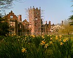
St Mary's, Tarleton geograph.org.uk 1399043

St Mary's Church is a redundant Anglican church on the A59 road as it passes to the south of the village of Tarleton, Lancashire, England. It is recorded in the National Heritage List for England as a designated Grade II* listed building, and is under the care of the Churches Conservation Trust. It is described by the Churches Conservation Trust as a "picturesque early Georgian chapel" with "a lovely unspoiled interior".

Excerpt from the Wikipedia article St Mary's Church, Tarleton (License: CC BY-SA 3.0, Authors, Images).

St Mary's Church, Tarleton
Bank Bridge, West Lancashire Tarleton

Geographical coordinates (GPS) Address Website Nearby Places
placeShow on map

Wikipedia: St Mary's Church, TarletonContinue reading on Wikipedia

Geographical coordinates (GPS)

Latitude Longitude
N 53.6748 ° E -2.8239 °
placeShow on map

Address

CHURCH OF ST MARY

Bank Bridge
PR4 6NB West Lancashire, Tarleton
England, United Kingdom
mapOpen on Google Maps

Website
historicengland.org.uk

linkVisit website

St Mary's, Tarleton geograph.org.uk 1399043
Share experience

Nearby Places

Bank Hall
Bank Hall

Bank Hall is a Jacobean mansion in Bretherton, Lancashire, England. It is a Grade II* listed building and is at the centre of a private estate, surrounded by parkland. The hall was built on the site of an older house in 1608 by the Banastres who were lords of the manor. The hall was extended during the 18th and 19th centuries. Extensions were built for George Anthony Legh Keck in 1832–1833, to the design of the architect George Webster. Legh Keck died in 1860 and the estates passed to Thomas Powys, 3rd Baron Lilford. The contents were auctioned in 1861 and the hall used as a holiday home and later leased to tenants. During the Second World War the Royal Engineers used it as a control centre. After the war the estate was returned to the Lilfords whose estate offices moved to the east wing of the house until 1972 when the house was vacated. The building was used as a location for the 1969 film The Haunted House of Horror. The house was vandalised causing rapid deterioration. In 1995 the Bank Hall Action Group (now Friends of Bank Hall) was formed to raise public awareness, collect funds, host events and clear the overgrown grounds. In 2003 Bank Hall was the first building to be featured in the BBC's Restoration television series. Since 2006 the action group and Urban Splash have planned to restore the house as apartments retaining the gardens, entrance hall and clock tower for public access and the Heritage Trust for the North West (HTNW) plans to renovate the potting sheds and walled gardens.

Hesketh Bank railway station

Hesketh Bank railway station was a railway station on the West Lancashire Railway (WLR) in North West England, which served the village of Hesketh Bank. The station, originally known as 'Hesketh Bank and Tarleton', opened on 20 February 1878 and was located on the western bank of the River Douglas near a dock where the WLR operated a steamship across the River Ribble to Lytham St Annes. By 1882 the station was referred to as 'Hesketh for Tarleton', but by 1895 the station appears to have been formally renamed to just 'Hesketh Bank'.The station was originally the northern terminus of what was to be the Southport-Preston Line, running from Hesketh Park on the northern outskirts of Southport; the line through to Preston was opened in September 1888 after the opening of a swing bridge over the Douglas in May of that year. An engine shed was located at the station but closed when the station became a through station, and was demolished by the following year.In 1880 a short goods line, approximately 1.25 miles (2 km) long, was opened along the west bank of the river to a terminus at Tarleton Lock, at the end of the Rufford Branch of the Leeds and Liverpool Canal. As the WLR did not own the land upon which the line was constructed, nor was it acquired by an Act of Parliament, the company had to pay a lease fee (presumably to the local borough council) until 3 September 1881, after the land was vested by Act to the WLR on 3 June 1881.The station closed on 7 September 1964 as a result of the Beeching axe, the buildings and platforms demolished and the rails removed by February 1965, and the land later developed as a housing estate.