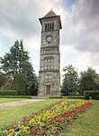
Wall, Staffordshire
AC with 0 elementsCivil parishes in StaffordshireHarv and Sfn no-target errorsLichfield DistrictVillages in Staffordshire

Wall is a small village and civil parish in Staffordshire, England, just south of Lichfield. It lies on the site of the Roman settlement of Letocetum. The parish includes the small villages of Pipehill, Hilton and Chesterfield, and the tiny hamlet of Aldershawe, which is about 1⁄2 mi (800 m) north of the village of Wall. The nearby junction of the A5 and A5127 roads and the M6 Toll motorway is often referred to as 'Wall Island'.
Excerpt from the Wikipedia article Wall, Staffordshire (License: CC BY-SA 3.0, Authors, Images).Wall, Staffordshire
Market Lane, Lichfield
Geographical coordinates (GPS) Address Nearby Places Show on map
Geographical coordinates (GPS)
| Latitude | Longitude |
|---|---|
| N 52.658 ° | E -1.854 ° |
Address
Market Lane
Market Lane
WS14 0AU Lichfield
England, United Kingdom
Open on Google Maps


