place

City of Preston, Lancashire

Boroughs in EnglandCities in North West EnglandCity of Preston, LancashireLocal government in PrestonNon-metropolitan districts of Lancashire
Pages including recorded pronunciationsPages with non-numeric formatnum arguments
Preston UK locator map

Preston ( ), commonly known as the City of Preston, is a local government district with city status in Lancashire, England. It lies on the north bank of the River Ribble and has a population of 147,617 (2021). The neighbouring districts are Ribble Valley, South Ribble, Fylde and Wyre. The district is named after its largest settlement, Preston, which lies in the south of the district. The district also includes rural areas to the north of the main urban area, including part of the Forest of Bowland, a designated Area of Outstanding Natural Beauty. In 2002 the district was granted city status to mark the Golden Jubilee of Elizabeth II; prior to this it was known as the Borough of Preston, having held borough status since its creation in 1974.

Excerpt from the Wikipedia article City of Preston, Lancashire (License: CC BY-SA 3.0, Authors, Images).

City of Preston, Lancashire
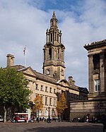
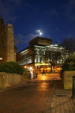
Market Square, Preston Avenham

Geographical coordinates (GPS) Address Nearby Places
placeShow on map

Wikipedia: City of Preston, LancashireContinue reading on Wikipedia

Geographical coordinates (GPS)

Latitude Longitude
N 53.759 ° E -2.699 °
placeShow on map

Address

Market Square

Market Square
Preston, Avenham
England, United Kingdom
mapOpen on Google Maps

Preston UK locator map
Share experience

Nearby Places

Preston, Lancashire
Preston, Lancashire

Preston ( ) is a city on the north bank of the River Ribble in Lancashire, England. The city is the administrative centre of the county of Lancashire and the wider City of Preston local government district. Preston and its surrounding district obtained city status in 2002, becoming England's 50th city in the 50th year of Queen Elizabeth II's reign. Preston has a population of 114,300, the City of Preston district 132,000 and the Preston Built-up Area 313,322. The Preston Travel To Work Area, in 2011, had a population of 420,661, compared with 354,000 in the previous census. Preston and its surrounding area have provided evidence of ancient Roman activity, largely in the form of a Roman road that led to a camp at Walton-le-Dale. The Angles established Preston; its name is derived from the Old English meaning "priest's settlement" and in the Domesday Book is recorded as "Prestune". In the Middle Ages, Preston was a parish and township in the hundred of Amounderness and was granted a Guild Merchant charter in 1179, giving it the status of a market town. Textiles have been produced since the mid-13th century when locally produced wool was woven in people's houses. Flemish weavers who settled in the area in the 14th century helped develop the industry. In the early-18th century, Edmund Calamy described Preston as "a pretty town with an abundance of gentry in it, commonly called Proud Preston". Sir Richard Arkwright, inventor of the spinning frame, was born in the town. The most rapid period of growth and development coincided with the industrialisation and expansion of textile manufacturing. Preston was a boomtown of the Industrial Revolution, becoming a densely populated engineering centre, with large industrial plants. The town's textile sector fell into terminal decline from the mid-20th century and Preston has subsequently faced similar challenges to other post-industrial northern towns, including deindustrialisation, economic deprivation and housing issues. Preston is the seat of Lancashire County Council, houses the main campus of the University of Central Lancashire (UCLan) and is home to Preston North End F.C., a founder member of the Football League and the first English football champions. The demonym for residents of the city is "Prestonian".