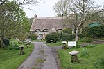
Kilmington, Wiltshire
Civil parishes in WiltshireEngvarB from August 2019OpenDomesdayPlaces formerly in SomersetVillages in Wiltshire

Kilmington is a village and civil parish in the extreme west of Wiltshire, England, about 8 miles (13 km) southwest of Warminster. The parish includes the hamlets of Kilmington Common and Norton Ferris. The parish lies on the northern edge of the ancient Selwood Forest. Whitesheet Hill is in the south-east of the parish, and Long Knoll (288m above sea level) is a long ridge on the northern parish boundary. Until 1896 Kilmington was in the historic county of Somerset, as part of the Norton Ferris Hundred.
Excerpt from the Wikipedia article Kilmington, Wiltshire (License: CC BY-SA 3.0, Authors, Images).Kilmington, Wiltshire
Geographical coordinates (GPS) Address Nearby Places Show on map
Geographical coordinates (GPS)
| Latitude | Longitude |
|---|---|
| N 51.127 ° | E -2.327 ° |
Address
BA12 6RD , Kilmington
England, United Kingdom
Open on Google Maps


