Arbat District
Arbat DistrictCentral Administrative OkrugUse mdy dates from April 2013
.png)
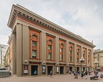
Arbat District (Russian: район Арбат) is a district of Central Administrative Okrug of the federal city of Moscow, Russia. Population: 28,179 (2010 Census); 25,699 (2002 Census).The district extends from central Mokhovaya Street west to Novoarbatsky Bridge over the Moskva River. Its irregular boundaries correspond roughly to Znamenka Street and Sivtsev Vrazhek Lane in the south and Povarskaya Street in the north. Main radial streets are Vozdvizhenka Street, New Arbat Street and pedestrian Arbat Street.
Excerpt from the Wikipedia article Arbat District (License: CC BY-SA 3.0, Authors, Images).Arbat District
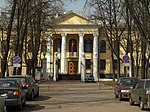
Bolshoy Nikolopeskovskiy Lane, Moscow Arbat District
Geographical coordinates (GPS) Address Nearby Places Show on map
 Continue reading on Wikipedia
 Geographical coordinates (GPS)
| Latitude | Longitude |
|---|---|
| N 55.751 ° | E 37.59 ° |
Address
Bolshoy Nikolopeskovskiy Lane 13
119002 Moscow, Arbat District
Moscow, Russia
Open on Google Maps