place

Carleton Heights

Neighbourhoods in OttawaUse Canadian English from January 2023
Carleton Heights Community Centre

Carleton Heights (French: Hauteurs Carleton) is a neighbourhood in River Ward in Ottawa, Ontario, Canada. According to the Carleton Heights and Area Community Association, the neighbourhood is bounded on the north by the Central Experimental Farm, on the east by the Rideau River, on the south by the junction of Prince of Wales Drive and Fisher Avenue and on the west by Fisher Avenue. The neighbourhood is sometimes referred to as Hog's Back after the nearby falls. The total population of the neighbourhood is 7,586 according to the Canada 2016 Census.Homes were developed after World War II in the main Carleton Heights neighbourhood (then part of Nepean Township), located south of Meadowlands Drive. Most of these homes were not built until c. 1950. The neighbourhood was originally built for War Veterans, thanks to the Veterans' Land Act. The houses were small, but were built on large lots (many of which were subdivided in the future). The Courtland Park section of the neighbourhood, located north of Dynes North was next to built. Rideau View, located between Dynes and Meadowlands, and east of Claymor Avenue was built next, in the early 1960s. This area was expanded by the construction of the Debra Dynes Community Housing project, the Prince of Wales Complex and Chateau Royale apartments (east of Prince of Wales) and the Carleton Square neighbourhood (west of Claymor) in the early 1970s. Finally, the Prince of Wales on the Rideau neighbourhood was built in the late 2000s.Carleton Heights has a community centre which is adjacent to the Carleton Heights Curling Club and Carleton Heights Public School.

Excerpt from the Wikipedia article Carleton Heights (License: CC BY-SA 3.0, Authors, Images).

Carleton Heights
Meadowlands Drive, (Old) Ottawa River

Geographical coordinates (GPS) Address Nearby Places
placeShow on map

Wikipedia: Carleton HeightsContinue reading on Wikipedia

Geographical coordinates (GPS)

Latitude Longitude
N 45.366666666667 ° E -75.705555555556 °
placeShow on map

Address

Meadowlands Drive 949
K2C 1N6 (Old) Ottawa, River
Ontario, Canada
mapOpen on Google Maps

Carleton Heights Community Centre
Share experience

Nearby Places

Rideau View
Rideau View

Rideau View (also spelled Rideauview) is a sub-neighbourhood of Carleton Heights in River Ward, in the west-end of Ottawa, Ontario, Canada, located near the Rideau River. It is bordered by Meadowlands Drive to the south, Claymor Avenue to the west and Dynes Road to the north. Debra Avenue is the main road that runs through the neighbourhood and there is some residential housing on Eiffel Avenue. Some of parts of the neighbourhoods are east of Prince of Wales Drive and runs parallel along the Rideau River. The area is also located close to the former city of Nepean. A major feature of the neighbourhood is a low-income housing project designed and built by the Ottawa Housing corporation. There are four high-rise condominiums on Prince of Wales at the corner of Dynes and Meadowlands. The population of this neighbourhood according to the Canada 2011 Census was 1880 The area is home to a diverse population of Black, Asian and Arab residents. Most people in the neighbourhood live under the poverty line and there is some crime in the area. A crime wave hit the area in the late 1980s and early 1990s when the neighbourhood was notorious for gun violence and drug trafficking. To prevent the neighbourhood from becoming plagued by crime, the police chief held a meeting with city officials to discuss options for decreasing crime in the neighbourhood. An increased police presence and undercover operations helped to reduce crime in the area and today the area is somewhat stable. A youth centre was opened by the Ottawa Police Service to provide alternatives for the youth to help them stay away from resorting to a life of crime and violence. The Debra-Dynes family house was opened as a community outreach centre and is located in the heart of the neighbourhood. The Greek Festival is held every August at the Greek Orthodox Church on Prince of Wales. It is home to Rideauview Bible Church, a Greek Orthodox church, the Ukrainian Catholic Shrine and Temple Israel (a Synagogue). The schools that serve the neighbourhood are Brookfield High School, Carleton Heights Elementary School, St.Pius X High School and Carleton University.

Hog's Back Falls
Hog's Back Falls

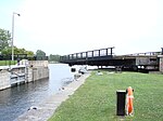
The Hog's Back Falls, officially known as the Prince of Wales Falls, but rarely referred to by this name, are a series of artificial waterfalls on the Rideau River in Ottawa, Ontario, Canada. The falls are located just north of Mooney's Bay and the point where the Rideau Canal splits from the Rideau River. Prior to the construction of the Rideau Canal, these were a gentle set of rapids originally known as Three Rock Rapids. The name Hog's Back came into use shortly before canal construction. Civil Engineer John MacTaggart, in 1827, described them as "a noted ridge of rocks, called the Hog’s Back, from the circumstances of raftsmen with their wares [timber rafts] sticking on it in coming down the stream." These rapids were about 600 metres (2 000 feet) in length with a drop of about 1.8 metres (6 feet). They were navigable by canoe; no portage was required. As part of his concept for a slackwater navigation system, Lt. Colonel John By's design for the Rideau Canal called for a large dam to be raised in this location. It would divert water from the Rideau River into the artificially-created section of the canal leading to the Ottawa locks. It would also flood the Three Island Rapids located upstream (the head of present-day Mooney's Bay marks the foot of these rapids). The building of this dam provided one of the greatest construction challenges (it collapsed three times during construction) of the Rideau Canal, but when completed in 1831, it flooded the Rideau River at that point by 12.5 metres (41 feet). To accommodate the natural flow of the Rideau River and to prevent damage from spring flooding, a large wastewater weir was constructed. The water from this flows through a channel that was excavated in the eastern bank of the Rideau River. This created the Hog's Back Falls that we see today. The head of the original rapids is now buried beneath the canal dam, but the lower section of the rapids can still be seen today. This location marks where the route of the Rideau Canal leaves the Rideau River and enters a manmade canal leading to the Ottawa locks. A series of locks lowers boats from this location to the Ottawa River.

Shevchenko Monument (Ottawa)

On The Shevchenko Monument is a bronze and granite monument of Taras Shevchenko, created by Leo Mol, that was unveiled on 26 June 2011 in Ottawa, Ontario, Canada.The composition of the monument includes four items: Taras Shevchenko, and three bas-relief figures complementing the composition. The central monument, sitting on a granite base approximately 8.5 m (28 ft) high, holds a young version of a standing Taras Shevchenko. Dressed in a long coat, the fashion at that time, he holds a palette and three paintbrushes and looks out into the distance. The figure is 3 m (9.8 ft) high and weighs 630 kg (1,390 lb). Three shorter bases hold artistic creations from his poetry. One of the bas-relief figures, standing 1.2 m (3 ft 11 in) and weighing 156 kg (344 lb), represents Haydamaky (referring to Haidamakas) an epic poem of Shevchenko's about the Cossack paramilitary bands that rose up against the szlachta (Polish nobility) in right-bank Ukraine in the 18th-century. The next, Kateryna with child (1.2 m (3 ft 11 in), 163 kg (359 lb)), recalls his early ballad about a Ukrainian girl seduced then abandoned by a Russian - symbolic of the tsarist imposition of serfdom in Ukraine and refers to Shevchenko's painting Kateryna.The last, Banduryst (1.2 m (3 ft 11 in), 156 kg (344 lb)), referring to the Kobzar and Bandura, a traditional Ukrainian stringed musical instrument shaped like a lute. Nearly 90,000 kg (200,000 lb) of Stanstead grey granite from Quebec, was used to create the bases for the monument.The monument is located the grounds of the Saint John the Baptist Ukrainian Catholic Shrine, 952 Green Valley Crescent, Ottawa, Ontario.

Prince of Wales on the Rideau

Prince of Wales on the Rideau is an affluent neighbourhood in Carleton Heights, River Ward, and Wellsmere Court in the west-end of Ottawa, Ontario, Canada. It consists of 210 homes on a peninsula between the Rideau River and Prince of Wales Drive, on the west shore of Mooney's Bay. Prior to its development in 2006/2007, the land was part of the Moffatt Farm. The Canadian government purchased the farm in 1940 for a Veterans home. Later it was made redundant and the National Capital Commission (NCC) brought it to enlarge their parkland. It was left unattended for a number of years, until the NCC made an exchange of properties with the developer. The disposal of Crown land by the NCC resulted in many objections from the public, making it one of the most controversial new homes projects in Ottawa in recent times. [1] Campanale Homes is the predominant developer, purchasing 132 building lots from the city for C$13.7 million. It boasts the highest price of new construction residential land in the city, due to its closeness to the Rideau River and downtown Ottawa. In 2006, Campanale Homes boasted having the most expensive new home in Ottawa. Currently, the most inexpensive home in the neighbourhood is 1,530-square-foot (142 m2) bungalow for $543,500 and the home values go up to about $3 million. Excluding Carillon Loop, which is in a different dissemination area, the population of the neighbourhood was 585 according to the Canada 2011 Census.