place

WNTP

1956 establishments in PennsylvaniaConservative talk radioRadio stations established in 1956Radio stations in PhiladelphiaSalem Media Group radio stations
Talk radio stations in the United States

WNTP (990 AM) is a commercial radio station in Philadelphia, Pennsylvania. WNTP is owned by the Salem Media Group and broadcasts a conservative talk radio format. Most of the programming comes from the co-owned Salem Radio Network including nationally syndicated hosts Mike Gallagher, Hugh Hewitt, Dennis Prager, Sebastian Gorka, Charlie Kirk, Brandon Tatum and Eric Metaxas. A local weekday wake-up show is hosted by Chris Stigall. By day, WNTP is powered at 50,000 watts, the maximum for U.S. commercial AM stations. To protect other stations at night, WNTP reduces power to 10,000 watts at sunset. It uses a directional antenna with a four-tower array. The station's studios and transmitter facilities are shared with co-owned WFIL on Ridge Pike in Lafayette Hill, Pennsylvania.

Excerpt from the Wikipedia article WNTP (License: CC BY-SA 3.0, Authors).

Geographical coordinates (GPS)

Latitude Longitude
N 40.095388888889 ° E -75.276569444444 °
placeShow on map

Address

Hunter Road
19462
Pennsylvania, United States
mapOpen on Google Maps

Share experience

Nearby Places

Plymouth Meeting Historic District

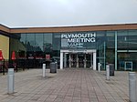
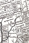
Plymouth Meeting Historic District is a national historic district that straddles Plymouth and Whitemarsh Townships in Montgomery County, Pennsylvania, United States. The adjacent Cold Point Historic District is north of it. The district encompasses 200 acres (81 ha) and includes 56 contributing buildings in the historic core of Plymouth Meeting. Among these are the separately-listed Plymouth Friends Meetinghouse (1708); Hinterleiter House (c.1714); Livezey House and Store (c.1740–1788); Hovenden House, Barn and Abolition Hall (c.1795, 1856); and Plymouth Meeting Country Store and Post Office (c.1827).The district was added to the National Register of Historic Places in 1971. Plymouth Meeting House is the name of a village situated at the intersection of the Plymouth and Perkiomen turnpikes, on the township line. On this [Plymouth] side is the meeting house, school house and four houses; and in Whitemarsh two stores, a blacksmith and wheelwright shop, post office and twenty-four houses. The houses in this village are chiefly situated along the Perkiomen or Reading pike, nearly adjoining one another, and being of stone, neatly white washed, with shady yards in front, present to the stranger an agreeable appearance. In the basement of the Library building the Methodists hold worship. This is an ancient settlement, whose history dates back nearly to the arrival of William Penn, and is marked as a village on Lewis Evans' map of 1749. The post office was established here before 1827. In 1832 there were but ten houses here. — History of Montgomery County (1858).

Cold Point Historic District

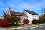
Cold Point Historic District is a national historic district located in Plymouth Township and Whitemarsh Township, Montgomery County, Pennsylvania. It is an eastward extension of the Plymouth Meeting Historic District. It encompasses 62 contributing buildings and 1 contributing site dated from 1745 to 1878 in the Village of Cold Point. It includes predominantly 2+1⁄2-story, stuccoed rubble stone structures dated to the early- to mid-19th century. A few reflect the Greek Revival and Gothic Revival styles. Notable buildings include the separately listed Alan West Corson Homestead, Cold Point Baptist Church and burial ground, and Cold Point School.It was added to the National Register of Historic Places in 1983. On the line adjoining Plymouth and Whitemarsh townships is an elevation known as Cold Point, where there is a scattered hamlet, containing on the Whitemarsh side more than a dozen houses. The Cold Point Baptist Church, located at this place, was first known as the Plymouth Church, and the locality became a preaching-place about 1842, when the Rev. Robert Young, then pastor of the Chestnut Hill Baptist Church, began service in the school-house, which then stood opposite the present church. The corner-stone of the old stone church edifice was laid in the summer of 1845, and after completion was in use until 1867. The corner-stone of the present stone house, sixty by forty feet, was laid in August of that year and completed and dedicated in 1868 and is still used. It stands a short distance west of the old church.The membership is about one hundred and fifty. The grounds occupy about two and a half acres and are kept in neat condition. We find on the tombstones the names of Freas, Rodebaugh, Lysinger, Fight, Phipps, Hellings, Williams, White, Sands, Bisbing, Hallet, Rex, Coulson, Moore, Robinson, Fisher, Nagle, Schlater, Yetter, Butler, Kirk, Radcliff, Getman, Wood, Jones, Childs, Wimmer, Roberts, Heller, Gilbert and Dewees. From these grounds a fine view is obtained of the surrounding country, particularly towards the north and west, embracing the greater portion of Plymouth township. Near this is the residence of the late Alan W. Corson, well known as a teacher, surveyor, nurseryman and botanist, who died June 21, 1882, aged ninety-five years. — History of Montgomery County (1884).

Spring Mill, Pennsylvania

Spring Mill is a small unincorporated community in Whitemarsh Township, Montgomery County, Pennsylvania. Located along the Schuylkill River, it lies between the community of Miquon and the Borough of Conshohocken. Conshohocken's southeast border cuts diagonally across the street grid – from 12th Avenue, south of Righter Street, to approximately where Cherry Street meets the river. "Spring Mill" was first a gristmill, built sometime between 1697 and 1704. The mill lent its name to Spring Mill Creek and the surrounding area. The mill burned in 1967, and its stone ruins were demolished. The miller's house survives, and is listed on the National Register of Historic Places.Spring Mill Station was established by the Reading Railroad about 1880. The modern station is part of the SEPTA Manayunk/Norristown Line. Located along the river at North Lane, it is subject to periodic flooding.The Schuylkill River Trail passes through the community. Spring Mill shares Conshohocken's 19428 zip code. Spring Mill until recently was the most populous village in the township, but owing to the demolition of its furnaces and several manufacturing establishments, its prosperity has been impaired. It is situated on the east side of the Schuylkill, with two railroads having double tracks passing through it from Philadelphia. It contains at present four stores, one hotel, two clay-works, a grist-mill, several mechanic shops and about fifty houses. The census of 1880 gives seven hundred and eighty-eight inhabitants; if this is no typographical error, it is entirely too high; the number of houses will not admit of half this population. Mr. Hitner has sold his two furnaces here to the Schuylkill Valley Railroad Company to give them room for improvements. The village received its name from several copious springs of water near by, the principal ones being five or six in number. They are all situated within an area of half an acre, and flow into one stream, which after a course of a quarter of a mile, empties into the Schuylkill. In this distance it has sufficient power to propel the whole year round the grist-mill mentioned, which was built here before 1715, and then owned by David Williams, next by Robert Jones. Thomas Livezey, in January 1812, advertised it for rent, stating that it was affected by "neither frost nor drought." Mr. Hitner's furnaces were erected here in 1844 and 1853, with an estimated capacity to produce annually twelve thousand tons of iron. John Meconkey advertised the tavern and ferry here for sale in December 1803, stating that the house was thirty-five by eighteen feet, two stories high, with an ice-house attached, and that the ferry had the advantage of not being fordable at any time of the year. Edge Hill crosses the Schuylkill just below the village, and continues up the other side of the river to West Conshohocken, where it turns to the southwest. The river is quite narrow where it flows through the hill and rises on both sides to an elevation of upwards of two hundred and fifty feet, contributing to the beauty of the scenery. Its flourishing neighbor, Conshohocken, bids fair to absorb the entire place, it being no easy matter now to a stranger to tell where the one begins and the other ends. The post-office here is called William Penn, and was established before 1876. — History of Montgomery County (1884).