Lamplighters Marsh
Parks and open spaces in Bristol

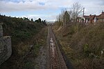
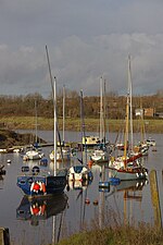
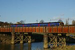
Lamplighters Marsh (grid reference ST524764) is a public open space and local nature reserve near Shirehampton in the city of Bristol, England. It is a narrow strip of land between the railway line which connects Bristol to Avonmouth, and the River Avon.
Excerpt from the Wikipedia article Lamplighters Marsh (License: CC BY-SA 3.0, Authors, Images).Lamplighters Marsh
Nibley Road, Bristol Shirehampton
Geographical coordinates (GPS) Address Nearby Places Show on map
Geographical coordinates (GPS)
| Latitude | Longitude |
|---|---|
| N 51.4824 ° | E -2.6807 ° |
Address
Nibley Road
BS11 9EQ Bristol, Shirehampton
England, United Kingdom
Open on Google Maps


