Frederiksgade
Streets in Copenhagen

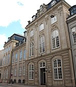
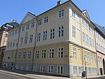
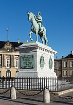
Frederiksgade is a street in the Frederiksstaden neighbourhood of central Copenhagen. It runs east from Store Kongensgade to Toldbodgade on the waterfront, passing the Marble Church, Bredgade and Amaliegade on the way. At the Marble Church the street splits and curves around both sides of the church before rejoining on its other side.
Excerpt from the Wikipedia article Frederiksgade (License: CC BY-SA 3.0, Authors, Images).Frederiksgade
Frederiksgade, Copenhagen Christianshavn
Geographical coordinates (GPS) Address Nearby Places Show on map
Geographical coordinates (GPS)
| Latitude | Longitude |
|---|---|
| N 55.684444444444 ° | E 12.591666666667 ° |
Address
Frederiksgade
Frederiksgade
1265 Copenhagen, Christianshavn
Capital Region of Denmark, Denmark
Open on Google Maps


