Hermannskoppe
Hesse geography stubsHills of HesseHills of the Spessart

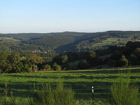
Hermannskoppe is a hill of Hesse, Germany. Its peak is located in the municipality of Flörsbachtal and is, at 567 m above NHN, the highest elevation of the Hessian part of the Mittelgebirge Spessart. It lies right on the border with the state of Bavaria. The hill is crossed by the historic road Birkenhainer Strasse which passes an old toll station nearby (Bayerische Schanz).
Excerpt from the Wikipedia article Hermannskoppe (License: CC BY-SA 3.0, Authors, Images).Hermannskoppe
Birkenhainer Straße, Flörsbachtal
Geographical coordinates (GPS) Address Nearby Places Show on map
Geographical coordinates (GPS)
| Latitude | Longitude |
|---|---|
| N 50.107222222222 ° | E 9.5166666666667 ° |
Address
Birkenhainer Straße
63639 Flörsbachtal, Rengersbrunn
Hesse, Germany
Open on Google Maps


