Vesterbro, Copenhagen
Copenhagen city districtsVesterbro, Copenhagen

Vesterbro is one of the 15 administrative, statistical, and city tax districts (bydele) comprising the municipality of Copenhagen, Denmark. It covers an area of 3.76 km2 (1.45 sq mi), has a population of 51,466 and a population density of 13,688 per km². Neighboring city districts are: to the northeast, the Indre By, also known as "Copenhagen Center", "Downtown Copenhagen" or "City". to the north, Frederiksberg municipality, which is not a part of Copenhagen municipality but rather an enclave surrounded by the municipality. to the west, Valby. to the south, Kongens Enghave.
Excerpt from the Wikipedia article Vesterbro, Copenhagen (License: CC BY-SA 3.0, Authors, Images).Vesterbro, Copenhagen
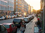
Sønder Boulevard, Copenhagen Vesterbro
Geographical coordinates (GPS) Address Nearby Places Show on map
Geographical coordinates (GPS)
| Latitude | Longitude |
|---|---|
| N 55.667222222222 ° | E 12.555 ° |
Address
Edison & co
Sønder Boulevard
1709 Copenhagen, Vesterbro
Capital Region of Denmark, Denmark
Open on Google Maps


