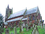
Westnewton, Cumbria

Westnewton is a small village and civil parish in Cumberland, Cumbria, England. The 2011 census had a population of 265. The village of Westnewton is situated to the north-west of the Lake District, on the relatively flat plain halfway between the Lake District hills and the Solway Firth. It is a small village located two miles north of Aspatria, on the B5301 Aspatria and Silloth road. The small hamlet of New Cowper is located one-and-a-half miles to the north-west. The landscape generally in this area is one of gently undulating fields, relatively devoid of features other than the thorn field-hedges, with shallow valleys carrying small streams, such as the Black Dub beck. Westnewton has a school called St Matthew's Church of England School, a church called St Matthew's Church, and a cemetery. There used to be a public house called the Swan Inn but this has closed.
Excerpt from the Wikipedia article Westnewton, Cumbria (License: CC BY-SA 3.0, Authors, Images).Westnewton, Cumbria
Wigton Road,
Geographical coordinates (GPS) Address Nearby Places Show on map
Geographical coordinates (GPS)
| Latitude | Longitude |
|---|---|
| N 54.784 ° | E -3.345 ° |
Address
Wigton Road
Wigton Road
CA7 3PE , Westnewton
England, United Kingdom
Open on Google Maps


