Pendeen

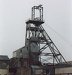
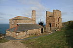
Pendeen (from Cornish: Penn Din meaning "headland fort", previously known as Cornish: Boskaswal Wartha, meaning "Caswal's high dwelling") is a village and ecclesiastical parish on the Penwith peninsula in Cornwall, England. It is 3 miles (5 kilometres) north-northeast of St Just and 7 mi (11 km) west of Penzance. It lies along the B3306 road which connects St Ives to Land's End and the A30 road. The village has a community centre, a shop, a post office, a primary school, and a few small businesses. Community activities include an art club, a gardening club, silver marching band and a football club. Nearby settlements include Carnyorth and Trewellard and the historic Geevor Tin Mine is immediately north of the village. The village gets its name from the headland on which Pendeen Lighthouse stands, a mile from the village. Like many other Cornish villages near the coast, Pendeen had a reputation for smuggling activities. Pendeen is overlooked by a hill, Carn Eanes, referred to locally as 'The Carn', the site of a quarry which provided the granite to build Pendeen church. Pendeen lies within the Cornwall Area of Outstanding Natural Beauty (AONB) and the St Just in Penwith division of Cornwall Council.Pendeen is close (1 km) to the South West Coast Path and in addition has a number of local footpaths for exploring the surroundings.
Excerpt from the Wikipedia article Pendeen (License: CC BY-SA 3.0, Authors, Images).Pendeen
B3306,
Geographical coordinates (GPS) Address Nearby Places Show on map
Geographical coordinates (GPS)
| Latitude | Longitude |
|---|---|
| N 50.1521 ° | E -5.6618 ° |
Address
B3306
TR19 7FA
England, United Kingdom
Open on Google Maps


