Sky King Airport
Airports in IndianaTransportation buildings and structures in Vigo County, Indiana

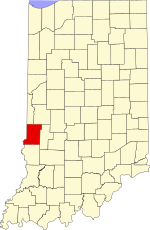
Sky King Airport (FAA LID: 3I3) is a public use airport located five nautical miles (9 km) north of the central business district of Terre Haute, a city in Vigo County, Indiana, United States.
Excerpt from the Wikipedia article Sky King Airport (License: CC BY-SA 3.0, Authors, Images).Sky King Airport
East Phylbeck Avenue,
Geographical coordinates (GPS) Address Nearby Places Show on map
 Continue reading on Wikipedia
 Geographical coordinates (GPS)
| Latitude | Longitude |
|---|---|
| N 39.547777777778 ° | E -87.377222222222 ° |
Address
East Phylbeck Avenue 2541
47805
Indiana, United States
Open on Google Maps