place

Greenwich Castle

Castles in LondonFormer buildings and structures in the Royal Borough of GreenwichFormer castles in EnglandGreenwich ParkLondon building and structure stubs
Royal residences in the Royal Borough of GreenwichRoyal residences in the United KingdomTudor royal palaces in England
Greenwich Park its history and associations (1902) (14780060514)

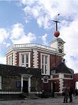
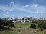
Greenwich Castle was a hunting lodge used during the reign of Henry VIII, located in Greenwich Park, in Greenwich, England. The Royal Observatory, Greenwich now stands on the site. Greenwich Castle was apparently a favourite place for Henry VIII to house his mistresses, as it was within easy travelling distance of Greenwich Palace at the foot of the hill.The castle was previously known as Duke Humphrey's Tower after its builder, Humphrey, Duke of Gloucester, a younger brother of King Henry V.

Excerpt from the Wikipedia article Greenwich Castle (License: CC BY-SA 3.0, Authors, Images).

Greenwich Castle
Duke Humphrey Road, London

Geographical coordinates (GPS) Address Website Nearby Places
placeShow on map

Wikipedia: Greenwich CastleContinue reading on Wikipedia

Geographical coordinates (GPS)

Latitude Longitude
N 51.4779 ° E -0.0019 °
placeShow on map

Address

Greenwich Park

Duke Humphrey Road
SE10 8QY London (Royal Borough of Greenwich)
England, United Kingdom
mapOpen on Google Maps

Website
royalparks.org.uk

linkVisit website

Greenwich Park its history and associations (1902) (14780060514)
Share experience

Nearby Places

Prime meridian (Greenwich)

The historic prime meridian or Greenwich meridian is a geographical reference line that passes through the Royal Observatory, Greenwich, in London, England. The modern IERS Reference Meridian widely used today is based on the Greenwich meridian, but differs slightly from it. The prime meridian was first established by Sir George Airy in 1851, and by 1884, over two-thirds of all ships and tonnage used it as the reference meridian on their charts and maps. In October of that year, at the behest of US President Chester A. Arthur, 41 delegates from 25 nations met in Washington, D.C., United States, for the International Meridian Conference. This conference selected the meridian passing through Greenwich as the official prime meridian due to its popularity. However, France abstained from the vote, and French maps continued to use the Paris meridian for several decades. In the 18th century, London lexicographer Malachy Postlethwayt published his African maps showing the "Meridian of London" intersecting the Equator a few degrees west of the later meridian and Accra, Ghana. The plane of the prime meridian is parallel to the local gravity vector at the Airy transit circle (51°28′40.1″N 0°0′5.3″W) of the Greenwich observatory. The prime meridian was therefore long symbolised by a brass strip in the courtyard, now replaced by stainless steel, and since 16 December 1999, it has been marked by a powerful green laser shining north across the London night sky. Global Positioning System (GPS) receivers show that the marking strip for the prime meridian at Greenwich is not exactly at zero degrees, zero minutes, and zero seconds but at approximately 5.3 seconds of arc to the west of the meridian (meaning that the meridian appears to be 102.478 metres east). In the past, this offset has been attributed to the establishment of reference meridians for space-based location systems such as WGS 84 (which GPS relies on) or that errors gradually crept into the International Time Bureau timekeeping process. The actual reason for the discrepancy is that the difference between precise GNSS coordinates and astronomically determined coordinates everywhere remains a localized gravity effect due to vertical deflection; thus, no systematic rotation of global longitudes occurred between the former astronomical system and the current geodetic system.

Royal Observatory, Greenwich

The Royal Observatory, Greenwich (ROG; known as the Old Royal Observatory from 1957 to 1998, when the working Royal Greenwich Observatory, RGO, temporarily moved south from Greenwich to Herstmonceux) is an observatory situated on a hill in Greenwich Park in south east London, overlooking the River Thames to the north. It played a major role in the history of astronomy and navigation, and because the Prime Meridian passes through it, it gave its name to Greenwich Mean Time, the precursor to today's Coordinated Universal Time (UTC). The ROG has the IAU observatory code of 000, the first in the list. ROG, the National Maritime Museum, the Queen's House and the clipper ship Cutty Sark are collectively designated Royal Museums Greenwich.The observatory was commissioned in 1675 by King Charles II, with the foundation stone being laid on 10 August. The site was chosen by Sir Christopher Wren, a former Savilian Professor of Astronomy; as Greenwich Park was a royal estate, no new land needed to be bought. At that time the king also created the position of Astronomer Royal, to serve as the director of the observatory and to "apply himself with the most exact care and diligence to the rectifying of the tables of the motions of the heavens, and the places of the fixed stars, so as to find out the so much desired longitude of places for the perfecting of the art of navigation." He appointed John Flamsteed as the first Astronomer Royal. The building was completed in the summer of 1676. The building was often called "Flamsteed House", in reference to its first occupant. The scientific work of the observatory was relocated elsewhere in stages in the first half of the 20th century, and the Greenwich site is now maintained almost exclusively as a museum, although the AMAT telescope became operational for astronomical research in 2018.

Greenwich
Greenwich

Greenwich ( (listen) GREN-itch, GRIN-ij, GRIN-itch, or GREN-ij) is a town in south-east London, England, located in the historic county of Kent and the ceremonial county of Greater London. It is situated 5.5 miles (8.9 km) east-southeast of Charing Cross. Greenwich is notable for its maritime history and for giving its name to the Greenwich Meridian (0° longitude) and Greenwich Mean Time. The town became the site of a royal palace, the Palace of Placentia from the 15th century, and was the birthplace of many Tudors, including Henry VIII and Elizabeth I. The palace fell into disrepair during the English Civil War and was demolished to be replaced by the Royal Naval Hospital for Sailors, designed by Sir Christopher Wren and his assistant Nicholas Hawksmoor. These buildings became the Royal Naval College in 1873, and they remained a military education establishment until 1998 when they passed into the hands of the Greenwich Foundation. The historic rooms within these buildings remain open to the public; other buildings are used by University of Greenwich and Trinity Laban Conservatoire of Music and Dance. The town became a popular resort in the 18th century and many grand houses were built there, such as Vanbrugh Castle (1717) established on Maze Hill, next to the park. From the Georgian period estates of houses were constructed above the town centre. The maritime connections of Greenwich were celebrated in the 20th century, with the siting of the Cutty Sark and Gipsy Moth IV next to the river front, and the National Maritime Museum in the former buildings of the Royal Hospital School in 1934. Historically an ancient parish in the Blackheath Hundred of Kent, the town formed part of the growing conurbation of London in the 19th century. When the County of London, an administrative area designed to replace the Metropolitan Board of Works, was formed in 1889, the parish merged with those of Charlton-next-Woolwich, Deptford St Nicholas and Kidbrooke to create the Metropolitan Borough of Greenwich. When local government in London was again reformed in 1965, it merged with most of the Metropolitan Borough of Woolwich, creating what is now the Royal Borough of Greenwich, a local authority district of Greater London.

Queen's House
Queen's House

Queen's House is a former royal residence built between 1616 and 1635 near Greenwich Palace, a few miles down-river from the City of London and now in the London Borough of Greenwich. It presently forms a central focus of what is now the Old Royal Naval College with a grand vista leading to the River Thames. Its architect was Inigo Jones, for whom it was a crucial early commission, for Anne of Denmark, the queen of King James VI and I. Queen's House is one of the most important buildings in British architectural history, being the first consciously classical building to have been constructed in the country. It was Jones's first major commission after returning from his 1613–1615 grand tour of Roman, Renaissance, and Palladian architecture in Italy. Some earlier English buildings, such as Longleat and Burghley House, had made borrowings from the classical style, but these were restricted to small details not applied in a systematic way, or the building may be a mix of different styles. Furthermore, the form of these buildings was not informed by an understanding of classical precedents. Queen's House would have appeared revolutionary to English eyes in its day. Jones is credited with the introduction of Palladianism with the construction of Queen's House, although it diverges from the mathematical constraints of Palladio, and it is likely that the immediate precedent for the H-shaped plan straddling a road is the Villa Medici at Poggio a Caiano by Giuliano da Sangallo. Today the building is both a Grade I listed building and a scheduled monument, a status that includes the 115-foot-wide (35 m), axial vista to the River Thames. The house now forms part of the National Maritime Museum and is used to display parts of its substantial collection of maritime paintings and portraits.

Crooms Hill
Crooms Hill

Crooms Hill is a residential street in Greenwich in South East London. The street name has been described as one of the oldest in London, possibly deriving from the Celtic word 'crom', meaning crooked.It runs uphill in a southerly direction for approximately 1 km (0.6 mi) from central Greenwich along the east side of Greenwich Park to Blackheath where it splits into Cade Road and General Wolfe Road, while Chesterfield Walk branches off towards the Ranger's House. The southern end was formerly called Heathgate Lane, possibly signifying the location of a gate onto the Heath.At the northern end are Greenwich Theatre and the adjacent Rose and Crown pub at a crossroads that links eastwards to King William Walk (via Nevada Street), northwards to Greenwich High Road (via Stockwell Street) and westwards to Royal Hill (via Burney Street). It is a largely residential street; near central Greenwich, it consists primarily of terraced townhouses; further south are larger individual houses. At the northern end of the road are blue plaques on the former residences of Cecil Day-Lewis and Benjamin Waugh, and the Fan Museum. This end of the street was served by Greenwich Park railway station in nearby Stockwell Street from 1888 to 1917. The Pevsner Guide describes Crooms Hill as "the pride of domestic architecture in Greenwich". Much of the housing dates from the seventeenth century to the early nineteenth century. Although some Tudor era buildings survive much of the land was developed when Greenwich Park was enclosed in 1619 leaving the road outside the walls. Many of the new residences were built by wealthy merchants and others from the City of London as second homes. About 0.7 km (0.4 mi) south of Greenwich town centre is the Catholic Our Ladye Star of the Sea, a Gothic Revival church designed by William Wardell in the 1840s.