Vogelsang (Bavarian Forest)
Bavaria geography stubsMountains of BavariaMountains of the Bavarian Forest

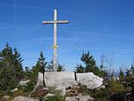
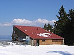
Vogelsang is a 1,022-metre-high (3,353 ft) mountain in Bavaria, Germany. It is located in the Bernried municipality, south-west of the Regen district and north-east of Deggendorf. It lies in the western foothills of the Bavarian Forest. Along with Butzen (775 m or 2,543 ft) and Hinterberg (666 m or 2,185 ft), Vogelsang forms the boundary of the Graflinger Valley. Other neighboring hills include Rauhe Kulm (1,050 m or 3,440 ft), Hochriedriegel (934 m or 3,064 ft), and Riedberg (998 m or 3,274 ft).
Excerpt from the Wikipedia article Vogelsang (Bavarian Forest) (License: CC BY-SA 3.0, Authors, Images).Vogelsang (Bavarian Forest)
Vogelsangstraße, Ruhmannsfelden (VGem)
Geographical coordinates (GPS) Address Nearby Places Show on map
Geographical coordinates (GPS)
| Latitude | Longitude |
|---|---|
| N 48.935 ° | E 12.943611111111 ° |
Address
Klosterstein
Vogelsangstraße
94239 Ruhmannsfelden (VGem)
Bavaria, Germany
Open on Google Maps


