Laufbacher Eck
Allgäu AlpsBavaria geography stubsMountains of BavariaMountains of the AlpsOberallgäu

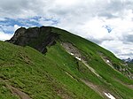
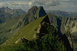
The Laufbacher Eck is a 2,178-metre-high grass mountain in the Allgäu Alps in the south German state of Bavaria.
Excerpt from the Wikipedia article Laufbacher Eck (License: CC BY-SA 3.0, Authors, Images).Laufbacher Eck
Bad Hindelang
Geographical coordinates (GPS) Address Nearby Places Show on map
Geographical coordinates (GPS)
| Latitude | Longitude |
|---|---|
| N 47.4 ° | E 10.383333333333 ° |
Address
Kuhplatten-Alpe
87541 Bad Hindelang
Bavaria, Germany
Open on Google Maps


