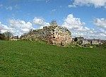
Roxburgh (village)
Villages in the Scottish Borders

Roxburgh (Gaelic, Rosbrog) is a village off the A699, by the River Teviot, near Kelso in the Scottish Borders area of Scotland. It should not be confused with the historic royal burgh of Roxburgh, the site of which lies about 2 miles (3.2 km) northeast of the present village. Other places nearby include Ednam, Heiton, Maxton, Morebattle, Smailholm, Sprouston and Stichill. The Borders Abbeys Way passes through the village.
Excerpt from the Wikipedia article Roxburgh (village) (License: CC BY-SA 3.0, Authors, Images).Roxburgh (village)
Teviot Road,
Geographical coordinates (GPS) Address Nearby Places Show on map
Geographical coordinates (GPS)
| Latitude | Longitude |
|---|---|
| N 55.569 ° | E -2.477 ° |
Address
Roxburgh Kirk
Teviot Road
TD5 8NE
Scotland, United Kingdom
Open on Google Maps


