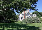
Rancho Arroyo de la Laguna
California ranchosRanchos of Santa Cruz County, California
Rancho Arroyo de la Laguna was a 4,418-acre (17.88 km2) Mexican land grant in present-day Santa Cruz County, California given in 1840 by Governor Juan B. Alvarado to Gil Sanchez. The grant extended along the Pacific coast south-east from Rancho San Vicente and San Vicente Creek (which runs through present day Davenport) to Laguna Creek and Rancho Refugio.
Excerpt from the Wikipedia article Rancho Arroyo de la Laguna (License: CC BY-SA 3.0, Authors).Rancho Arroyo de la Laguna
Geographical coordinates (GPS) Address Website Nearby Places Show on map
Geographical coordinates (GPS)
| Latitude | Longitude |
|---|---|
| N 37.01 ° | E -122.16 ° |
Address
California Coastal National Monument (Cotoni-Coast Dairies Unit)
95017
California, United States
Open on Google Maps


