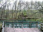
Ilme
Lower Saxony river stubsRivers of GermanyRivers of Lower SaxonySollingSpecial Protection Areas ... and 1 more
Tributaries of the Leine

The Ilme is a left-bank, western tributary of the River Leine in Lower Saxony, Germany. It is 33.0 km (20.5 mi) long. The river begins at the pond Neuer Teich in the centre of the Solling hills at an elevation of 340 m above sea level (NN) and flows initially northwards to Dassel, then in an easterly direction through Markoldendorf (a district of Dassel) to Einbeck, after which it discharges into the Leine near Volksen at an elevation of 105 m (344 ft).
Excerpt from the Wikipedia article Ilme (License: CC BY-SA 3.0, Authors, Images).Ilme
L 487,
Geographical coordinates (GPS) Address Nearby Places Show on map
Geographical coordinates (GPS)
| Latitude | Longitude |
|---|---|
| N 51.815 ° | E 9.925 ° |
Address
L 487
37574
Lower Saxony, Germany
Open on Google Maps


