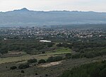
Rancho Ex-Mission la Purisima
Rancho Ex-Mission la Purísima (also called Rancho Purísima) was a 14,736-acre (59.63 km2) Mexican land grant in present-day Santa Barbara County, California given in 1845 by Governor Pío Pico to Jonathan Temple. The rancho derives its name from the secularized Mission La Purísima, but was called ex-Mission because of a division made of the lands held in the name of the Mission— the church retaining the grounds immediately around, and all of the lands outside of this are called ex-Mission lands. The grant was north of the Santa Ynez River and present-day Lompoc and encompasses present-day Vandenberg Village. The grant was defined by the boundaries of the earlier surrounding grants, viz: Rancho Mission Vieja de la Purisma, Rancho Jesús María, Rancho Lompoc, Rancho Los Álamos, and Rancho Santa Rita.
Excerpt from the Wikipedia article Rancho Ex-Mission la Purisima (License: CC BY-SA 3.0, Authors).Rancho Ex-Mission la Purisima
Burton Mesa Boulevard,
Geographical coordinates (GPS) Address Nearby Places Show on map
Geographical coordinates (GPS)
| Latitude | Longitude |
|---|---|
| N 34.7 ° | E -120.45 ° |
Address
Burton Mesa Boulevard 783
93436
California, United States
Open on Google Maps


